RUSSIAN JOURNAL OF EARTH SCIENCES, VOL. 19, ES6008, doi:10.2205/2019ES000680, 2019
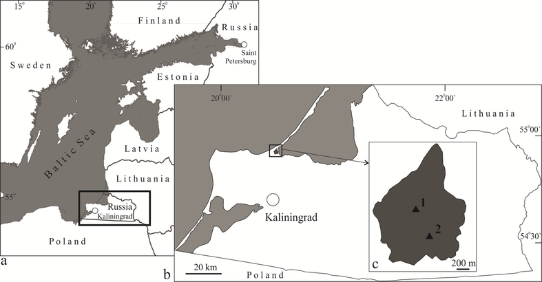
Figure 1. Sketch map of the study area (a) and the site of investigation (b, c). Locations of the boreholes for taking samples are indicated by the triangles.

![]()
Citation: Napreenko Maxim G., Tatiana V. Napreenko-Dorokhova, Dmitry A. Subetto (2019), Reconstruction of a coastal raised bog development in the proximal part of the Curonian Spit, Kaliningrad Region, Russia, South-Eastern Baltic, Russ. J. Earth Sci., 19, ES6008, doi:10.2205/2019ES000680.
Copyright 2019 by the Geophysical Center RAS.
Generated from LaTeX source by ELXfinal, v.2.0 software package.