RUSSIAN JOURNAL OF EARTH SCIENCES, VOL. 19, ES5003, doi:10.2205/2019ES000675, 2019
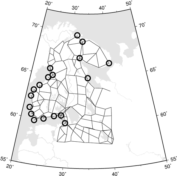
Figure 2. The total levelling network and the tide gauges (open circles). In this paper only the Baltic tide gauge rates are used. For the purposes of the adjustment, the a-priori standard error of 0.5 mm/year was assigned to them. The presentation of the network is schematic, straight lines connect the nodal points.

![]()
Citation: Kaftan Vladimir, Jaakko Mäkinen (2019), Fennoscandian uplift study as an example of Russian-Finnish cooperation in Arctic geodesy (Advisory), Russ. J. Earth Sci., 19, ES5003, doi:10.2205/2019ES000675.
Copyright 2019 by the Geophysical Center RAS.
Generated from LaTeX source by ELXfinal, v.2.0 software package.