RUSSIAN JOURNAL OF EARTH SCIENCES, VOL. 19, ES2008, doi:10.2205/2019ES000658, 2019
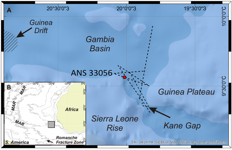
Figure 1. Study area north of the Kane Gap (A). The dotted line marks the traverse of the seismoacoustic profiling and multibeam echo sounding. The position of the study area in the Atlantic Ocean (B). MAR – Mid-Atlantic Ridge. The map was created using an Esri ArcGIS$^{\circledR}$ software; isobaths are given after [Becker et al., 2009].

![]()
Citation: Sivkov V. V., L. D. Bashirova, E. V. Dorokhova, M. V. Kapustina, E. P. Ponomarenko (2019), Study of the Contourite Drift north of the Kane Gap (eastern equatorial Atlantic), Russ. J. Earth Sci., 19, ES2008, doi:10.2205/2019ES000658.
Copyright 2019 by the Geophysical Center RAS.
Generated from LaTeX source by ELXpaper, v.2.0 software package.