RUSSIAN JOURNAL OF EARTH SCIENCES, VOL. 17, ES4002, doi:10.2205/2017ES000605, 2017
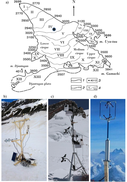
Figure 1. a) Scheme of the Djankuat glacier [Popovnin et al., 2015]: 1 – glacier boundaries, 2 – ice divides, 3 – mountain peaks and their altitudes, 4 – numbers of morphological zones. Black point indicates the location of meteorological site where the following observations are carried out: radiation fluxes and basic meteorological variables from the AWS CAMPBELL (b); basic meteorological variables from gradient mast DAVIS (c); turbulent pulsations of wind and temperature from sonic anemometer GILL (d).

![]()
Citation: Toropov P. A., A. A. Shestakova, A. M. Smirnov (2017), Methodological aspects of heat balance components estimation on mountain glaciers, Russ. J. Earth Sci., 17, ES4002, doi:10.2205/2017ES000605.
Copyright 2017 by the Geophysical Center RAS.
Generated from LaTeX source by ELXpaper, v.1.5 software package.