RUSSIAN JOURNAL OF EARTH SCIENCES, VOL. 17, ES3003, doi:10.2205/2017ES000602, 2017
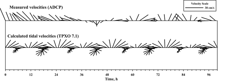
Figure 6. Velocity vectors based on four-day mooring measurements (station 5528) of bottom flow in the Bear Island Trough on July 24–28, 2017 at 73° 15.6$'$ N, 17° 24.6$'$ E; and calculated tidal velocities for the same period.

![]()
Citation: Frey D. I., A. N. Novigatsky, M. D. Kravchishina, E. G. Morozov (2017), Water structure and currents in the Bear Island Trough in July–August 2017, Russ. J. Earth Sci., 17, ES3003, doi:10.2205/2017ES000602.
Copyright 2017 by the Geophysical Center RAS.
Generated from LaTeX source by ELXpaper, v.1.5 software package.