RUSSIAN JOURNAL OF EARTH SCIENCES, VOL. 17, ES3003, doi:10.2205/2017ES000602, 2017
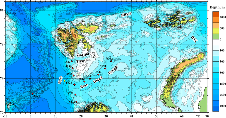
Figure 1. Locations of the measurements in the western Barents Sea in July–August 2017. Red circles show our CTD stations; red diamond is the site of mooring deployment in the Bear Island Trough; yellow diamond is the mooring location in 1995. Bathymetry is based on GEBCO 2014 data. Abbreviations: Northern Barents Sea Opening (NBSO); Barents Sea Opening (BSO); Barents Sea Exit (BSX).

![]()
Citation: Frey D. I., A. N. Novigatsky, M. D. Kravchishina, E. G. Morozov (2017), Water structure and currents in the Bear Island Trough in July–August 2017, Russ. J. Earth Sci., 17, ES3003, doi:10.2205/2017ES000602.
Copyright 2017 by the Geophysical Center RAS.
Generated from LaTeX source by ELXpaper, v.1.5 software package.