RUSSIAN JOURNAL OF EARTH SCIENCES, VOL. 14, ES2005, doi:10.2205/2014ES000542, 2014
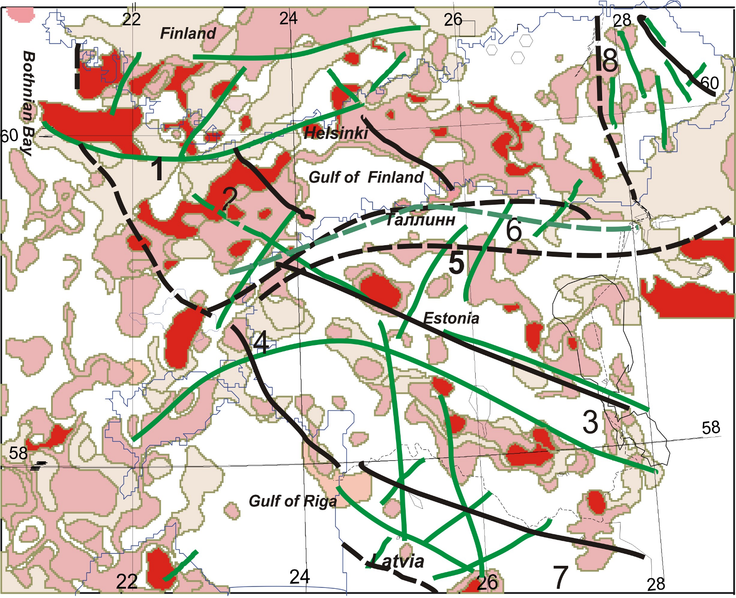
Figure 7. Maximum values ($> 0.68$) of parameter (see text) (shown in shades of red and pink). Geological faults are shown by green lines; active lineaments according to GPS are marked by black lines: solid and dashed lines show reliable or unreliable revealing respectively. Faults: 1, Southern Finland shear zone; 2, fault Skonsero; 3, Paldisky–Pskov deformation zone; 4, Middle Estonian fault, 5, Tapa fault zone; 6, Koporsky fault; 7, North Latvian fault zone.

![]()
Citation: Assinovskaya B. A., M. K. Ovsov (2014), Seismotectonic zoning of the Finnish–Bothnia region based on the structural analysis method, Russ. J. Earth Sci., 14, ES2005, doi:10.2205/2014ES000542.
Copyright 2014 by the Geophysical Center RAS.
Generated from LaTeX source by SemTeXML, v.1.2 software package.