RUSSIAN JOURNAL OF EARTH SCIENCES, VOL. 12, ES4004, doi:10.2205/2012ES000519, 2012
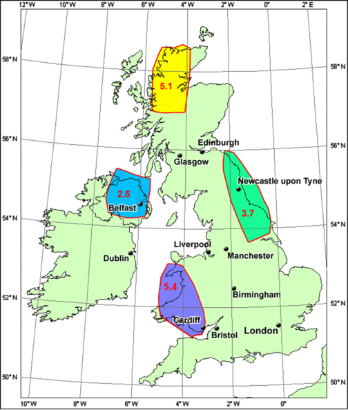
Figure 5. Regional model of the GUZs obtained using GEO-GIS. The numbers inside each zone indicate the predicted maximum earthquake magnitude within that zone.
![]()
![]()
Citation: Blinova Tatiana S., J. Russ Evans, David C. Booth, Irina I. Semerikova, Yuriy V. Baranov (2012), An integrative approach to seismic hazard and its application to the UK region, Russ. J. Earth Sci., 12, ES4004, doi:10.2205/2012ES000519.
Copyright 2012 by the Geophysical Center RAS.
Generated from LaTeX source by SemTeXML, v.1.2) software package.