RUSSIAN JOURNAL OF EARTH SCIENCES, VOL. 12, ES4004, doi:10.2205/2012ES000519, 2012
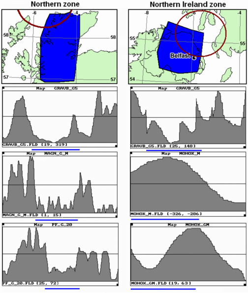
Figure 4. Features of identification of the Northern and Northern Ireland GUZs. Features: GRAVB_G5 – gradient of gravitational field (scale ($\times 10^{-2}$), mGal/km), MAGN_G_M – gradient of magnetic field (scale, nT/km), PF_G_20 – gradient of vertical crustal motions (scale ($\times 10^{-4}$), mm/yr/km), MOHOK_M – depth to Moho (scale (:10), km), MOHOK_GM – gradient of depth to Moho (scale, m/km). Circles – zones of intersection of fault systems.
![]()
![]()
Citation: Blinova Tatiana S., J. Russ Evans, David C. Booth, Irina I. Semerikova, Yuriy V. Baranov (2012), An integrative approach to seismic hazard and its application to the UK region, Russ. J. Earth Sci., 12, ES4004, doi:10.2205/2012ES000519.
Copyright 2012 by the Geophysical Center RAS.
Generated from LaTeX source by SemTeXML, v.1.2) software package.