
E. A. Rogozhin1, A. G. Gurbanov2, A. V. Marakhanov1, A. N. Ovsyuchenko1, A. V. Spiridonov1, and E. E. Burkanov1
1United Institute of Physics of the Earth, Russian Academy of Sciences, Moscow, Russia
2Institute of Geology of Ore Deposits, Petrography, Mineralogy, and Geochemistry, Russian Academy of Sciences, Moscow, Russia
Natural catastrophes that take place in the densely populated territory of the North Caucasus, with its national and social problems, are fraught with serious ecological, political, and economic consequences. For this reason the study of the mechanisms that cause large earthquakes, volcanic eruptions, and the exogenic catastrophic phenomena that accompany them is an urgent scientific task. During the last decade of the 20th century the Caucasus region experienced a series of large earthquakes, this suggesting its obvious seismic reactivation. Most of the sources of the large earthquakes (Chaldyra in 1976, Paravan in 1986, Spitak in 1988, Racha in 1991, and Borisakh in 1992) were concentrated in the largest geological structure crossing the Caucasus region in the meridional direction, namely, in the Trans-Caucasus transverse rise which is a collision-associated structural feature of the continent-continent type.
|
|
| Figure 1 |
 5, 28
3, 23
2, ~21, ~9.2-9.3, ~7.8-8.0, ~7.2,
~6.0, ~4.9, and ~4.6 thousand years ago and during the first and second centuries
A.D.
[Bogatikov et al., 1998;
Laverov, 2002].
Also reported in the literature are the volcanic eruptions dated approximately 1.3
and 1.0 thousand years ago
[Laverov, 2002].
These eruptions included lava flows, hot gas ejections, ash
clouds, and catastrophic lahars. The research
work done in 2002-2003 proved two of these eruptions using radiocarbon dating of
the paleosoil. One of
these events took place about 6000 years ago and was accompanied by lahar flows.
The material of one of
the lahars covered the paleosoil dated 6410
100 years ago (Sample IGAN 2616) on the high terrace
rising
40-50 m above the flood plain in the left side of the Baksan R. in the
mouth of its left tributary, known as
the Kyldybashsu R. (Figure 1, Site 2). The second volcanic eruption has been
dated using the results of
studying the paleosoil covered by lake deposits at the third terrace above the flood
plain of the Kyzylkol River
(in the upper reaches of the Malka R.). This soil horizon was dated 1780
70 years (IGAN 2591). It
reflects the process of the rapid burying of the humus-rich soil under the deposits
of the dammed lake
which was produced by the damming of the Kyzylkol River by a lava flow in its near-mouth
area. At about
the same time a rock avalanche took place in the upper reaches of the Baksan R.
(somewhat lower down
the flow of the river, near the Elbrus Settlement). The paleosoil horizon buried
under the avalanche
material has a radiocarbon age of 1630
50 years (Sample IGAN 2612). It appears that this
avalanche arose
during the eruption of the volcano and was caused by moderate seismic movements that
accompanied this eruption.
5, 28
3, 23
2, ~21, ~9.2-9.3, ~7.8-8.0, ~7.2,
~6.0, ~4.9, and ~4.6 thousand years ago and during the first and second centuries
A.D.
[Bogatikov et al., 1998;
Laverov, 2002].
Also reported in the literature are the volcanic eruptions dated approximately 1.3
and 1.0 thousand years ago
[Laverov, 2002].
These eruptions included lava flows, hot gas ejections, ash
clouds, and catastrophic lahars. The research
work done in 2002-2003 proved two of these eruptions using radiocarbon dating of
the paleosoil. One of
these events took place about 6000 years ago and was accompanied by lahar flows.
The material of one of
the lahars covered the paleosoil dated 6410
100 years ago (Sample IGAN 2616) on the high terrace
rising
40-50 m above the flood plain in the left side of the Baksan R. in the
mouth of its left tributary, known as
the Kyldybashsu R. (Figure 1, Site 2). The second volcanic eruption has been
dated using the results of
studying the paleosoil covered by lake deposits at the third terrace above the flood
plain of the Kyzylkol River
(in the upper reaches of the Malka R.). This soil horizon was dated 1780
70 years (IGAN 2591). It
reflects the process of the rapid burying of the humus-rich soil under the deposits
of the dammed lake
which was produced by the damming of the Kyzylkol River by a lava flow in its near-mouth
area. At about
the same time a rock avalanche took place in the upper reaches of the Baksan R.
(somewhat lower down
the flow of the river, near the Elbrus Settlement). The paleosoil horizon buried
under the avalanche
material has a radiocarbon age of 1630
50 years (Sample IGAN 2612). It appears that this
avalanche arose
during the eruption of the volcano and was caused by moderate seismic movements that
accompanied this eruption.
As a result of the geological, geophysical, geochemical and other observations, carried out in the recent years, a large magma chamber was discovered in the central part of the Earth crust [Avdulov and Koronovskii, 1993; Laverov, 2002]. Therefore Elbrus cannot be ranked as an extinct volcano, but can be qualified as a temporarily sleeping one [Bogatikov et al., 2003; Koronovskii, 1985; Koronovskii and Milanovskii, 1960]. In other words, we have every reason to expect a new reactivation of volcanic processes in the Elbrus volcanic center (EVC).
The estimation of a seismic hazard for the Caucasus region, based on the cluster analysis of the geological, geophysical, and seismological data [Reisner and Ioganson, 1993], proves that the Elbrus area has a potential earthquake source (PES) with a predicted maximum earthquake magnitude of 7.2 [Rogozhin, 2002]. During the instrumental and historical periods of observations this source manifested itself very poorly. In essence, the Elbrus region is a large zone of seismic quiescence, where neither weak nor moderate shocks are recorded, not to mention any large seismic events. This can be explained by the fact that the melt that now fills the large magma chamber relieves the stress in the Earth crust, so that seismic shocks do not arise. At the same time the data collected by different researchers about paleoseismic dislocations suggest that very large earthquakes might have taken place there in the past [Bogatikov et al., 2003; Laverov, 2002; Nikonov, 1991]. Taking into account the above information, it seems urgent to investigate the seismic and volcanic events that take place in the region of the Elbrus volcanic center. The aim of our research was to clarify whether these events accompany one another or they are unrelated in terms of the time of their occurrence.
Considering the urgent character of this problem, field investigations were arranged to study the geology and geomorphology of the Elbrus region for the purpose of finding the traces of old unknown large earthquakes, that is, any paleoseismic dislocations [Solonenko, 1973]. The existence of paleoseismic dislocations that had been produced in the Greater Caucasus region by large earthquakes of the past has been proved by many researchers in other regions: in the Northwest Caucasus [Rogozhin et al., 2002], in the West Caucasus and in Svanetia [Khromovskikh et al., 1979], in Mountainous Dagestan, and in North Osetiya [Nikitin, 1987]. Therefore, the finding and study of ground surface disturbances, that remained from ancient earthquakes, in the Central Caucasus region seemed to be promising. The authors of this paper intended to study both primary (seismotectonic) and secondary (gravitation and vibration) deformations. In the course of studying these objects we intended to collect samples of the material that had been buried during the operation of the respective processes, which was expected to contain organic matter suitable for dating the seismic dislocations and, hence, for timing the earthquakes that had produced them. The resulting rock samples were dated using the radiocarbon ( 14 C) method at the pertinent laboratory of the Institute of Geography, Russian Academy, by a group of researchers headed by O. A. Chichagova. The comparison of the numerous dating results for seismic dislocations of different origins allowed the more reliable reconstructions and timing of old earthquakes as compared to the dating of individual dislocation types. The resulting age values were used to correlate the periods of large earthquakes with the known periods of the volcanic eruptions.
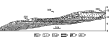
The field study of the traces of the large earthquakes that had occurred during the prehistoric past in the Elbrus volcanic center, namely, in the Baksan R. basin, in the valleys of the Biitik-Tebe and Kyukyurtly Rivers (Kuban R. upper reaches), and in the upper reaches of the Malka River, resulted in locating paleoseismic dislocations of both primary seismotectonic origin, and of secondary seismogravitational and vibration origin (Figure 1).

|
| Figure 2 |
 1.4 km
2 ) flat
graben-shaped basin of a Second World War airdrome, known as the Irakhik-Syrt area,
on the northern
slope of the volcanic cone (Figure 1, Site 1). The total length of the
fault system exceeds 5 km, some
individual faults being traced for distances of 800-1000 m. The faults (left-lateral
normal faults) break the
Paleozoic bedrocks in the zone of the Pshekish-Tyrnyauz Fault and the moraine-covered
surface of the late
Pleistocene (40-45 thousand years) Kyzylkol dacite lava flow and produce steps in
the topography of the
ridges and around the "Aerodrom'' Plateau. The breaks in the plateau surface are
accompanied, throughout
their lengths, by narrow linear pockets of abnormally thick paleosoil (as thick as
1 m with the normal
thickness of the modern soil being 5-15 cm), the base of which includes angular
fragments of dacite which
composes (in its bedrock position) the relatively upthrown western limb (Figure 2). The
total magnitude of the
modern vertical normal-fault displacement along this system of faults may be 1.5-2.0 m,
being as large as
50-100 m for the recent history. The pulse-type normal fault movement of about
1 m might have occurred
somewhat earlier, about 2280
90 years ago, as follows from the radiocarbon dating
of the lower paleosoil
layer from a near-fault pocket (Sample IGAN 2592). Approximately at the same time,
2520
60 years ago
(Sample GIN 9114), a gravitational avalanche of a huge rock mass took place in the
upper reaches of the Biitik-Tebe R.
[Laverov, 2002]
(Figure 1,
Site 5), obviously provoked by some ancient earthquake.
1.4 km
2 ) flat
graben-shaped basin of a Second World War airdrome, known as the Irakhik-Syrt area,
on the northern
slope of the volcanic cone (Figure 1, Site 1). The total length of the
fault system exceeds 5 km, some
individual faults being traced for distances of 800-1000 m. The faults (left-lateral
normal faults) break the
Paleozoic bedrocks in the zone of the Pshekish-Tyrnyauz Fault and the moraine-covered
surface of the late
Pleistocene (40-45 thousand years) Kyzylkol dacite lava flow and produce steps in
the topography of the
ridges and around the "Aerodrom'' Plateau. The breaks in the plateau surface are
accompanied, throughout
their lengths, by narrow linear pockets of abnormally thick paleosoil (as thick as
1 m with the normal
thickness of the modern soil being 5-15 cm), the base of which includes angular
fragments of dacite which
composes (in its bedrock position) the relatively upthrown western limb (Figure 2). The
total magnitude of the
modern vertical normal-fault displacement along this system of faults may be 1.5-2.0 m,
being as large as
50-100 m for the recent history. The pulse-type normal fault movement of about
1 m might have occurred
somewhat earlier, about 2280
90 years ago, as follows from the radiocarbon dating
of the lower paleosoil
layer from a near-fault pocket (Sample IGAN 2592). Approximately at the same time,
2520
60 years ago
(Sample GIN 9114), a gravitational avalanche of a huge rock mass took place in the
upper reaches of the Biitik-Tebe R.
[Laverov, 2002]
(Figure 1,
Site 5), obviously provoked by some ancient earthquake.
The western slope of the Elbrus Mt. shows another series of active faults expressed as a series of steep meridional scarps. Similar scarps also frame the Ulluchiran Glacier (Figure 1, Site 3) and can be traced southward from the tongue of the latter. It appears that these topographic forms are normal faults of earthquake origin.
A Chemartkol active fault zone of a nearly latitudinal strike extends in the middle of the slope in the right side of the Biitik-Tebe Valley (Figure 1, Site 12). This fault enters the zone of the Pshekish-Tyrnyauz old crustal fault, being located in its southern part. The fault is represented by a series of en-echelon faults totaling 1-3 km in length and having a WNW trend.
The system of the Chemartkol faults can be used to follow the traces of recent intensive right-lateral shear faults. They are expressed as the high asymmetry of the counterforts of the northern sides of the Biitik-Tebe and Ullukhurzuk river valleys. The eastern slopes of these counterforts are rectilinear and are oriented across the strikes of the river valleys and the Sadyrlyar Range. At the same time, the western slopes of the counterforts are highly curved in map view and acquire a NE and even a nearly latitudinal strike up the slope. This results in the highly asymmetric structure of the counterforts. The lower parts of the latter are displaced 250-300 m westward relative to the upper parts, this displacement being restricted to the narrow zone of the Chemartkol fault which is expressed in the topography as a chain of saddles.

|
| Figure 3 |
40 years (IGAN 2827). It is important to note that
this age value almost coincides with the age of the
buried paleosoil from a fault wedge at the Irakhik-Syrt Plateau (see above).

|
| Figure 4 |

|
| Figure 5 |
The rock sequence described seems to be the product of three
earthquake events. The abnormally
thick paleosoil horizons had been formed in a narrow valley, which marked the downthrown
limb of a fault.
It appears that each cycle of soil formation in this trench began after each successive
pulsed movement
along the fault. The lower horizon of the oldest paleosoil (Horizon 4 in Figure 2)
has a radiocarbon age of
5730
80 years (IGAN 2826). This date correlates well
with the seismic event that took place
approximately 5500-5700 years ago. The younger paleosoil (Horizon 3 in Figure 2) has
a radiocarbon age of
2970
30 years (IGAN 2824). At the same time there is
an obvious indication for an older earthquake which
occurred 3900 years ago. It can be supposed that this horizon was formed after this
seismic displacement.
Both events caused large rock avalanches and the formation of dammed lakes in the
Baksan Valley and are
discussed in detail here somewhat later in the section devoted to dammed lakes.
The bottoms of the modern soils (Horizon 1 in Figure 2) have
a radiocarbon age of 1640
40 years.
This soil "seals'' the fault, which may indicate that it had ceased to be active
after the time of 1600 years. It
is significant that this date correlates well with the time of the last Elbrus eruption,
1800 years ago
[Laverov, 2002].
It is possible that the last seismic movement was associated with this
event. On the other hand, the arc-shaped subsidence of a modern soil horizon in the
central part of the
paleoseismic trench suggests that the slow upthrust movements continued throughout
that period of time.
To sum up, the study of the seismic rupture in the trench resulted in finding the traces of two old earthquakes which had taken place about 5500-5700 and about 3900 years ago, which produced a two-stage colluvial wedge and two buried paleosoil horizons. Another interesting result is the indication that the Elbrus eruption that took place about 1800 years ago was accompanied by seismic activity.

|
| Figure 6 |
40 years (IGAN 2822). In other segments the fault
is marked by an earthquake scarp and by mineral
and fresh water springs (Figure 1, Site 13). In the upper reaches of the Ullukhurzuk
River, in its right-hand
side, the fault is represented by an en-echelon series of active faults demonstrating
left-lateral shear
displacements. The fault displacement magnitude was estimated, using the displacement
of an old
avalanche body, found at the right side of the Ullukhurzuk River 1 km higher
upstream from the area where
its left tributary (Kichkinekol) flows into this river. Here, an avalanche body composed
of large granite

|
| Figure 7 |

|
| Figure 8 |
As follows from the above description, both of the active faults of the Caucasus orientation, mapped in the area northwest of Elbrus, namely, the Kyukyurtly and Chemartkol ones, are still active in terms of geologic and seismic activity. Both faults show both horizontal displacements (right-lateral in the former case and left-lateral in the latter and also vertical movements (upthrust in the former case and downthrust in the latter).
Where the faults intersect the Elbrus caldera [Bogatikov et al., 1998], their structure grows more complicated, and they are marked by broad (2-3 km) zones of en-echelon ruptures (Figure 1). The Chemartkol Fault joins the Kyzylkol Fault in the east, and the Kyukyrtly Fault joins the Syltran Fault in the southeast. So, the faults of the Caucasus strike are kind of get inscribed into the given young concentric structural pattern. The Adylsu Fault, extending in the southern part of the Elbrus caldera for a distance of about 30 km, is also of earthquake origin. In terms of its structure this is a typical earthquake trench. Its modern horizontal movements are typical right-lateral displacements. Earthquakes seem to have occurred repeatedly causing landslides and rock falls and producing dammed lakes in the Baksan R. area. It appears that this fault had been reactivated 300-400 and about 5500 years ago.

|
| Figure 9 |
There are at least two generations of secondary slope earthquake
dislocations. The older rockfalls and landslides show smooth
surfaces, the large blocks in their clastic material are covered
by a desert varnish, are overgrown densely with desert lichen, and
a thick modern soil has been formed. The samples of these modern
soils, collected in different localities of this region
have been dated ( 14 C) 110
30 (IGAN 2620), 180
30
(IGAN 2621), and 210
30 (IGAN 2617) years. The bodies of these
landslides and rock falls rest on the low, 10- and 20-meter Late
Pleistocene terraces of the Baksan R. flood plain [Reisner and Bogachkin,
1989]. At the same time they are covered
by the alluvium and prolluvium material transported from the
valleys of the side tributaries. Proceeding from the radiocarbon
dating of the coals from an earthquake avalanche body in the lower
course of the Adyrsu R. (Site 7 in Figure 1), which yielded an age
of 2810
70 years (IGAN 2586), and from the earlier radiocarbon
dating of the paleosoil from under an earthquake produced
avalanche body measuring 3.5
10
6 m
3 in the source
area of the Biitik-Tebe River (Site 5 in Figure 1) with a
radiocarbon age of 2520
60 years [Laverov, 2002]
(IGAN 2586), the earthquake that produced these avalanches might
have occurred roughly 2300-2400 years ago.
The younger seismogravitational dislocations are distinguished
by a relatively more fresh
appearance of the rock-fall and landslide masses, by the absence of desert varnish
on the large fragments
and by a thin modern soil. They cover the 5- and 6-meter Holocene terraces of the
Baksan River
[Reisner and Bogachkin, 1989]
and even extend as far as the flood plain. Some bodies of these avalanches are
covered by the proluvial material of the alluvial fans of the side tributaries. The
radiocarbon dating of the
paleosoil, covered by the earthquake produced avalanche material at the right bank
of the Baksan River
(Figure 1,
Site 10) opposite Elbrus (400
70 years ago, IGAN 2590), suggests that that another
younger
earthquake took place about 300-400 years ago, which provoked the reactivation of
these catastrophic
gravitational slope activities.
In some areas the older collapse material is covered by the later ones, where the paleosoil is hidden under the avalanche rock masses of the latter. It appears that there had been even older avalanches and landslides, though their traces have not been found thus far.
In the course of this study we found a few sequences of lake
deposits resting on the old alluvial
terraces in the Baksan and Adyrsu river valleys. It appears that these lakes had
been of dam origin and were
formed as a result of old avalanches which dammed the river courses. We found four
generations of these
paleolakes. Our dating of coal and paleosoil from the basis of the lake deposits
crowning a 40-50-meter
terrace above the flood plain in the left side of the Baksan R. Valley suggested
that a dammed lake had
existed there near the mouth of the Kyldybashsu tributary during two periods of time.
(Figure 1,
Site 17). The
first lake originated 6410
100 years ago (IGAN 2616), the second, about 5510
40 years ago (IGAN 2610).
Somewhat earlier than the time when this second lake was filled with water (6170
years ago) and after its
existence (4900 years ago) catastrophic lahars descended down the Baksan R.
Valley over a distance of 70 km
from the volcanic cone
[Laverov, 2002],
the formation of which was associated undoubtedly
with the volcanic activity which caused the rapid melting of the glaciers. This provides
an example of the
distinct alternation of volcanic and seismic activities in time.
The two other ancient lakes have been reconstructed in the
Baksan R. Valley, in the area of the
Elbrus Settlement (Figure 1, Site 4) and slightly higher up the river from
the Tyrnyauz Settlement (Figure 1,
Site 2) based of the analysis of the ages of the paleosoils covered by the lake
deposits. These two lakes, spaced
20-25 km from one another, had been formed almost simultaneously. One of them
originated 3870
90
years ago (IGAN 2613), the other, 3840
50 years ago (IGAN 2588).

|
| Figure 10 |
70 years ago. Its origin seems to have been associated
with the collapse at the right side of the
Baksan R. Valley of a huge rock avalanche composed of granite blocks, varying
in size, from the right side
of the Baksan Valley. The body of this avalanche, known as the Tyubele Swell
[Koronovskii and Milanovskii, 1960;
Nikonov, 1991]
was had been spread over the terrace, overlapped the deposits of an old

|
| Figure 11 |
A few dammed lakes originated in different places of the
Elbrus region comparatively recently.
For instance, one of the low terraces above the floodplain at the
right bank of the Baksan River, slightly up the Tyrnyauz Town
(Figure 1,
Site 11), was found to contain lake deposits from which
ancient coals were collected. Their
14 C age was found
to be 490
30 years (Sample IGAN 2611). A lake was also formed
in the upper reaches of the Adyrsu R. (Figure 1, Site 6)
as a
result of damming the river by a huge rock avalanche in the area
of the present-day Dzhailyk Camp of alpinists. The paleosoil
overlain by the lake deposits was dated 430
60 years (Sample
IGAN 2619). Lake sediments with occasional charcoal remains were
found in the area of the Elbrus Settlement (Figure 1, Site 4) on
the first terrace of the Baksan R. left side. The radiocarbon age
of this coal was found to be 340
150 years (Sample IGAN 2585).
The paleosoil covered by the lake deposits has been dated
530
30 years (Sample IGAN 2618). To sum up, at least
three
lakes had existed almost simultaneously in the time interval of
400-500 years ago.

|
| Figure 12 |
|
| Figure 13 |

|
| Figure 14 |

|
| Figure 15 |
40 years (Sample IGAN 2822).
Neptunian dikes up to 5 m long and 10-20 cm wide have been found and documented in the right, northern side of the Kyukyurtly Glacier trough (Site 20 in Figure 1). They intersect a tuff sequence covered by a moraine. The material filling the dikes is a sand and clay mixture of alluvial-limnic origin, composed of a rewashed volcanic material. In one place a dike of this kind was found to displace an alluvium interlayer, like a normal fault, over a distance of about 2 m. It should be noted that the dikes here have a submeridional strike, that is, transverse relative to the strike of the Kyukyurtly Fault. The age of the dikes was not determined.
As seen from the above material, various topographic disturbances, such as active seismic breaks, avalanches, rock falls, dammed lakes, and neptunian dikes, acted repeatedly during short periods of time, sometimes almost in a synchronous manner, in different areas of this mountainous zone in the course of its Holocene evolution (Figure 6). These intervals were separated by the periods of time when no such processes developed. It appears that the short periods during which the young rock sequences and the topography were violated can be confidently identified with the moments of large earthquakes. This is undoubtedly true for the cases of finding seismic breaks and ground liquefaction structures (Figures 2, 4, 6). In the case of gravitational slope structures and dammed lakes, their seismic origin can be proved by the coincidence of the time of their formation with the time of the origin of primary seismic dislocations or vibration marks.
An additional confirmation of the seismic origin of the three dammed lakes discovered
in this
study (the upper course of the Adyrsu R., the left side of the
Baksan R. Valley in the area of the Elbrus Settlement, and the
right side of the Baksan R. Valley, somewhat higher than the
Tyrnyauz Town) is the fact that they originated synchronously in
different areas, situated far from one another, this procedure
having been repeated two times. The deposits of these lakes differ
in lithology and have different thicknesses. Yet, there exists one
property which is common for all of them. Each rock sequence
includes two horizons of buried paleosoil or coalified organic
matter found at the same stratigraphic levels: at the base and in
the upper third of the sequence. We collected samples from all of
them for the purpose of their radiocarbon dating which proved that
their ages in all three sites turned out to be very close for each
horizon, respectively. Moreover, the ages of upper horizon
correlate well with the Terek earthquake which took place in
1688
1 year [Kondorskaya and Shebalin, 1977].
Most of the very large earthquakes showed an independent
character, yet, in some cases seem to have occurred shortly before
or accompanied the large eruptions of the volcano.

|
| Figure 16 |
The first earthquake was accompanied by the rising of an earthquake source to the ground surface in the form of an earthquake break in the zone of the Chemartkol Fault with the formation of the lower colluvial wedge (see Site 16 in Figure 1 and Figure 5), and by the origin of a dammed lake in the Baksan Valley near the mouth of the Kyldybashsu River. This earthquake seems to have caused the emplacement of numerous neptunian dikes which can be observed in the layered sequence of the fluvioglacial volcanomictic sand at the northern slope of Elbrus near the end of the Ulluchiran Glacier (Site 3 in Figure 1; see also Figures 13 and 14).
The second seismic event was also accompanied by the formation of two dammed lakes in the Baksan R. Valley: in the area of the Elbrus Settlement and higher upstream from the Tyrnyauz Town (Figure 1, Sites 2, 4, and 11). It appears that at least two natural dams were formed in the Baksan R. Valley.
The third earthquake was accompanied by the emergence of a break in the Chemartkol Fault zone with the formation of an upper colluvial wedge and a buried soil lens (Figure 1, Site 16, and Figure 5). This earthquake also produced a meridional break in the flat surface of the Irakhik-Syrt Plateau (also known as the Aerodrom Plateau) on the northeastern slope of the volcanic cone (Figure 1, Site 1) and caused avalanches in the lower course of the Adyrsu River, in the Tyubele Swell, and in the source area of the Biitik-Tebe River (Sites 7, 8, 5, and 12 in Figure 1).
Finally, the fourth seismic event was accompanied by large collapses in the upper reaches of the Adyrsu and Yusenga rivers and in the Baksan R. Valley east of Elbrus Settlement (Sites 6, 4, 10, and 11 in Figure 1), which caused the formation of several dammed lakes (in the area of the present-day Elbrus. Settlement, in the upper reaches of the Adyrsu River, and in the area of the Baksan River higher than Tyrnyauz Town).
The magnitudes of these three reconstructed paleoearthquakes, which had occurred
in the Elbrus
region about 2300, 3200, and 5500 years ago, can be estimated from the magnitudes
of the earthquake
produced displacements in the zone of the reactivated seismic fault, and from the
areas involved in the
primary and secondary (gravitation and vibration) dislocations. For instance, the
magnitude of the vertical
earthquake-related displacement in the Chemartkol fault zone was about 30 cm
in the first case and about
50 cm in the second and third events. Using the known relationships between
the size of an earthquake
displacement and the magnitude of the earthquake that caused it, the latter can be
estimated as 6.3-6.6
[Wells and Coppersmith, 1994].
The dislocations produced by the paleoearthquakes that took place about
2300 and 3200 years ago were found in an area of about 45
20 km
2. The source area of this kind is
typical of earthquakes with magnitudes of 6.5 to 7.0.
There is historical evidence that a large earthquake occurred on the northern slope
of the Greater
Caucasus in the year of 1688
1, that is, more than 300 years ago
[Kondorskaya and Shebalin, 1977].
This earthquake is known as a Terskii event and, as follows from the catalog data,
had the coordinates of
43.7o
1o N and 44.7o
1o E, a magnitude of 5.3
0.7 and an intensity of 7
1. The Terskii earthquake caused
the destruction of buildings. It cannot be ruled out that this earthquake generated
the above mentioned
young seismic dislocations in the Baksan R. and Adyrsu R. valleys, the
coordinates of which are given in
the catalog mentioned above. At the same time the evidence given in the catalog about
the position of the
epicentral region of this seismic catastrophe and its magnitude is obviously highly
approximate. In reality,
the earthquake source might have been located somewhere in the Elbrus region, and
its magnitude might
have been higher than 6.5.
By and large, the seismic dislocations, varying in age and nature, that manifested themselves in the Elbrus region, form an oval area in map view (Figure 1) with the Elbrus Volcano residing in its western part, the long axis of which is oriented in the Caucasian, WNW, direction and coincides almost wholly with the Syltran magma-controlling fault. Restricted to this fault zone are the main volcanic apparatuses of Elbrus, the Syltran volcanic cone, and a series of necks in the source areas of the Kyukyurtly and Ullu-Kam rivers. The northern boundary of this area extends along the northern limb of the Pshekish-Tyrnyauz Fault, the southern boundary extending in the middle courses of the Adylsu R. (Shkhelda R. mouth) and the Adyrsu R. (in the area of the Novyi Dzhailyk Camp of alpinists). The western boundary of this "oval'' can be traced in the upper part of the mountainous segment of the Kuban R. Valley, and the eastern one does not extend beyond the Tyrnyauz Town meridian. Consequently, the length of the area of the paleoseismic dislocations of all ages is about 50 km, its width being 20-25 km. This area coincides roughly with the potential earthquake source (PES) located by a seismotectonic method. The size of the seismic dislocation zone generally corresponds to the size of the pleistoseist region of an earthquake with a magnitude of 7.0 and the crustal position of its source [Wells and Coppersmith, 1994]. Outside of this oval region, neither primary seismic dislocations nor gravitational slope structural features (seismic or aseismic) have been found over the distances of dozens of kilometers.
The comparison of the periods of seismic reactivation, proved by the paleoseismological data mentioned above, with the periods of the Holocene volcanic activity of Elbrus [Laverov, 2002; Rogozhin et al., 2001] shows that these two forms of endogenic activity replaced periodically one another in time. The repetition period of large earthquakes was 1500-1900 years, and that of volcanic eruptions, 1000-2000 years. Moreover, there is no coherence in the manifestations of these two natural catastrophes, even though volcanic eruptions can be accompanied by a moderate earthquake activity.
This relationship between two different forms of catastrophic endogenic activity can be explained by the geodynamic position of the Elbrus caldera in the system of the active faults in this region. The oval caldera, slightly elongated in the meridional direction, is bordered in the north by a system of active faults in the Pshekish-Tyrnyauz crustal disjunction zone, namely by the Chemartkol and Kyzylkol right-lateral strike-slip faults (Figure 1). In the south the caldera is cut also by the Adylsu active right-lateral fault. In response to the right-lateral seismic impulse-type and geological creep-type displacements along the northern and southern surroundings, the caldera area and the Syltran WNW trending left-lateral fault intersecting it in its central part happen to be in the environment of nearly latitudinal extension and basement subsidence in the manner similar to pull-apart basins. The environment of a nearly latitudinal extension is typical of the meridional structural features in the Trans-Caucasus transverse uplift. The Ararat and Aragats volcanic cones in the Minor Caucasus region are associated with similar types of uplifts. In particular, extension in the Elbrus Caldera is caused by meridional active normal faults.
The active seismogenic movements along the faults in the northern and southern surroundings of the caldera produced channels in the crystalline basement for the magma flowing from the middle to the upper crust, namely to a volcanic chamber. During this procedure the magma heats the crust in the volcanic area, this relieving the tension capable of producing large earthquakes. After the volcanic eruption the lithosphere cools off, looses its plastic state, and starts to accumulate elastic stress again. The magma flow channels become healed. As seismic movements renew, the whole procedure repeats itself from the very beginning.
This study proved that the Elbrus volcanic center is also dangerous in terms of earthquakes. Seismic and volcanic activities took place there repeatedly both during the Holocene and the Late Pleistocene. The long repetition periods (many hundred and even a few thousand years) of high-magnitude earthquakes characteristic of the Caucasus region as a whole [Khromovskikh et al., 1979; Rogozhin, 2002; Rogozhin et al., 2002; Solonenko, 1973], as well as catastrophic volcanic eruptions [Bogatikov et al., 1998, 2003; Laverov, 2002; Rogozhin et al., 2001] cause the seeming quietness of Elbrus at the present time. The seismic quiescence of the present time can be associated with the particular rheologic conditions of the Earth's crust necessary for the formation of a large earthquake source. At the same time the absence of modern earthquakes can be indicative of the growing danger of a large volcanic eruption of Elbrus in the near geological future.
Avdulov, M. V., and N. V. Koronovskii (1993), The geological nature of the Elbrus gravity low, Moscow University Bulletin, Ser. Geology, 4(3), 32-39.
Bogatikov, O. A., I. V. Melekestsev, A. G. Gurbanov, et al. (1998), Elbrus caldera (North Caucasus), Dokl. Russ. Akad. Nauk, 363(4), 515-517.
Bogatikov, O. A., E. A. Rogozhin, A. G. Gurbanov, et al. (2003), Old earthquakes and volcanic eruptions in the Elbrus region, Dokl. Russ. Akad. Nauk, 390(4), 511-516.
Khromovskikh, V. S., V. P. Solonenko, R. M. Semenov, and V. M. Shilkin (1979), Paleoseismology of the Greater Caucasus, 188 pp., Nauka, Moscow.
Kondorskaya, N. V., and N. V. Shebalin (Eds.) (1977), A New Catalog of Large Earthquakes in the Territory of the USSR from Ancient Times to 1975, 535 pp., Nauka, Moscow.
Koronovskii, N. V. (1983), A Guide for a Geological Excursion over the Caucasus, 97 pp., Moscow University.
Koronovskii, N. V. (1985), Elbrus as an Active Volcano, Priroda, (8), 42-52.
Koronovskii, N. V., and E. E. Milanovskii (1960), The origin of the Tyubele Swell in the Baksan Ravine (Central Caucasus), Moscow University Herald, (5), 69-78.
Koronovskii, N. V., and L. M. Rudakov (1962), On the age of the last Elbrus eruptions, Izv. Vuzov, Geology and Exploration, (8), 133-135.
Laverov, N. P. (Ed.) (2002), Catastrophic Processes and Their Effects on the Environment, Volcanism, vol. 1, 435 p., Regional Society for Applied Geophysical Problems, Moscow.
Milanovskii, E. E., and N. V. Koronovskii (1973), Orogenic Volcanism and Tectonics in the Alpine Belt of Eurasia, 279 pp., Nedra, Moscow.
Milanovskii, E. E., L. M. Rastsvetaev, S. U. Kukhmazov, et al. (1989), The recent geodynamics of the Elbrus-Mineralnye Vody region in the North Caucasus, in The Geodynamics of the Caucasus, pp. 99-105, Nauka, Moscow.
Nikitin, M. Yu. (1987), The neotectonics of the East Caucasus, Byul. MOIP, Ser. Geol., 62(3), 21-36.
Nikonov, A. A. (1991), Paleoseismic dislocations in the axial zone of the Main Caucasus Range (Elbrus region), Doklady AN SSSR, 319(5), 1183-1186.
Obermeier, S. F. (1995), Using liquefaction-induced features for paleoseismic analysis, in Using Ground-Failure Features for Paleoseismic Analysis, U.S.G.S., Open File Rep. 94-663, pp. 1-56.
Reisner, G. I., and B. M. Bogachkin (1989), Antropogene Stratigraphy and Tectonics of the North Caucasus Region, 195 pp., Institute of the Physics of the Earth, Moscow.
Reisner, G. I., and L. I. Ioganson (1993), The earthquake potential of Western Russia and other former USSR republics, in Seismicity and Seismic Regions in North Eurasia, Iss. 1, pp. 186-195.
Rogozhin, E. A. (2002), Modern geodynamics and potential earthquake sources in the Caucasus region, in Modern Mathematical and Geological Models of the Natural Environment, pp. 244-254, Institute of the Physics of the Earth, Moscow.
Rogozhin, E. A., L. E. Sobisevich, Yu. V. Nechaev, et al. (2001), Geodynamics, Seismotectonics and Volcanism in the North Caucasus Region, edited by N. P. Laverov, 338 pp., published by the Regional Organization of Geophysicists, Moscow.
Rogozhin, E. A., S. L. Yunga, A. V. Marakhanov, E. A. Ushanova, A. N. Ovsyuchenko, and V. A. Dvoretskaya (2002), Seismic and tectonic activity of faults on the south slope of the NW Caucasus, Russian J. Earth Sci., 4(3), 233-241, http://www.agu.org/WPS/rjes/v04/tje02095/tje02095.htm or http://rjes.wdcb.ru/v04/tje02095/tje02095.htm
Solonenko, V. P. (1973), Paleoseismology, Physics of the Earth, (9), 3-16.
Wells, D. L., and K. J. Coppersmith (1994), New empirical relationships among magnitude, rupture length, rupture width, rupture area, and surface displacements, Bull. Seismol. Soc. Am., 84(4), 974-1002.