
N. M. Chumakov
Geological Institute, Russian Academy of Sciences, Moscow
Global climate in the Late Precambrian, including the Vendian, has long been the subject of debate. Climatic zoning on the Earth has varied substantially throughout geologic history; therefore, in addition to the climate of EW trending zones, one should distinguish the Earth's global climate, which is determined by the totality and character of climatic zones [Chumakov, 2003]. In the Phanerozoic and Proterozoic, two main types of global climate are distinguishable: non-glacial and glacial [Chumakov, 1995b].
Evidence of glaciations are common in rocks of this age and the first paleomagnetic determinations of their paleolatitudes led some researchers in the 1960s to the hypothesis of a global "infra-Cambrian''1 glaciation [Harland, 1964]. This hypothesis was based on the assumed synchroneity of nearly all Late Proterozoic tillites and on low paleomagnetic latitudes in the rocksalternating with tillites in Spitsbergen and Greenland. It was soon found, however, that these low-angle paleomagnetic vectors were not primary but of much later age.Simultaneously, it was shown that Late Precambrian glacial deposits belong to at least four different glaciations separated by tens and hundreds of millions of years [Cahen, 1963; Chumakov, 1964, 1978b; Martin, 1965]. Thus, both of the original premises for the hypothesis of global glaciation in the "infra-Cambrian'' proved to be erroneous. The increasing number of determinations of low paleomagnetic latitudes, however, continued to sustain an interest in this hypothesis. In recent years it has regained its popularity under the name of "snowball Earth'' [Hoffman and Schrag, 2002; Kirschvink, 1992b; Schrag et al., 2002]. According to this hypothesis, the Earth in the Late Riphean and Early Vendian was repeatedly and completely covered by thick ice sheets from pole to pole, including the oceans. It is assumed that each of these glaciations lasted for several million to tens of millions of years. This much time is required for the volcanic CO 2 to accumulate in the atmosphere to a level necessary for the global glaciation to cease. This hypothesis was used in fairly speculative explanations of some isotopic and sedimentation anomalies (negative d13C values, carbonates at the top of glacial successions (cap carbonates), the appearance of iron ores, etc.), and these explanations are likewise regarded as supplementary arguments for the "snowball Earth'' hypothesis. This hypothesis will be examined in more detail below in the section "Early Vendian.''
There are also some alternative explanations for the "paradox of low-latitude glaciations.'' According to one of them, many deposits believed to be glacial are actually of a different origin [Klitin, 1965; Rampino, 1994; Schermerhorn, 1974; etc.]. Numerous in-depth investigations conducted by many scientists on different continents have confirmed, however, a glacial origin for most of the previously described Late Precambrian tillites, including those of Vendian age [for a review see Chumakov, 1978b; Crowell, 1999; Deynoux et al., 1994; Hambrey et al., 1981; etc.]. Therefore, this explanation was discarded. Another alternative hypothesis had it that during glaciations the Earth's axis was tilted at more than 54o. In this case the low latitudes received annually less heat than polar regions [Williams, 1975]. There are several facts to prove this hypothesis to be untenable [Chumakov, 1992], the most important of them being as follows. First, with such a position of the rotational axis, the Earth's low-latitude regions are bound to have two warm seasons (spring and fall) with equatorial and tropical weather, which will preclude the preservation of snow and ice until the next winter and, hence, the accumulation of perennial snow that could produce glaciers. Second, the large axial tilt will substantially (almost by a factor of three) decrease the contrast between the pole and the equator as regards the annual amount of insolation [Monin and Shishkov, 1979], but it will greatly enhance the seasonal temperature contrasts between the polar and low-latitude regions of the Earth and, consequently, enhance circulation in the atmosphere and hydrosphere. The latter, even when being less vigorous (as, e.g., during the ice-free Cretaceous period), was capable of smoothing out significantly larger latitude contrasts in the annual insolation, and there is no doubt that small differences in the case in question would have been leveled off. Third, G. Williams' hypothesis requires not only a very large axial tilt but also its multiple changes because low paleomagnetic latitudes were inferred both for the Vendian and the Late Riphean glaciation, each consisting of several glacial and interglacial episodes. The mechanism of such frequent changes of the axial tilt is currently unknown to astronomers and is not confirmed by the available geological data.
Other hypotheses have also been advanced. For example, that the low-latitude glaciations were caused by the appearance of dust rings (similar to those of Saturn) around the Earth, which shadowed the equatorial regions of our planet [Sheldon, 1982]; that the precession rate of the Earth's axis increased tens of thousands of times and reached one revolution per year [Malcuit and Winters, 1980]; or that the velocity of the Earth's rotation around its axis decelerated to zero, after which it began to rotate in the opposite direction [Aksirov, 1989].
The last examples show how far some researchers have gone from geological facts and phenomena in attempting to explain the "paradox of low-latitude glaciations.'' The large number of hypotheses proposed and their contradictory nature attest to the objective difficulties in solving this problem and the lack of any conclusive solutions at present.
Direct application to the Precambrian of the paleoclimatic reconstruction methods developed for the Phanerozoic [Chumakov and Zharkov, 2002, 2003; Chumakov et al., 1995; etc.] is hampered by four circumstances [Chumakov, 2001].
The first and main difficulty arises from the low resolution of the Vendian stratigraphy compared to the Phanerozoic. In view of this, for the Vendian (the shortest and best studied division of the Precambrian), inter-regional and especially global stratigraphic correlations can be performed to an accuracy not exceeding tens of millions of years. In two to three of the best studied sequences, the Vendian was divided into five widely correlative units on the basis of ichno- and microfossil complexes, isotopic datings and anomalies of stable isotopes, and the presence of Ediacaran faunas and glacial horizons [Knoll, 2000; Walter et al., 2000]. Six stratigraphic levels have been identified in White Sea sequences in the Middle Vendian from metazoan faunal assemblages [Fedonkin, 2003]. In the great majority of other Vendian sequences, such a set of stratigraphic data is insufficient to subdivide and especially to globally correlate regional units. On the global scale, only three units in Vendian sequences appear to be currently distinguishable and correlatable, which will be discussed later. The remaining stratigraphic horizons distinguished in the Vendian system are regional. At best, inter-regional correlations are possible for them on the basis of fragmentary paleontological and isotopic data. Therefore, it is very difficult to constrain the age and synchroneity of climatically significant Late Precambrian deposits and climatic indicators on different continents. Purely lithologic comparisons in inter-regional and especially intercontinental correlations of Vendian deposits cannot be used owing to the inevitable facies changes, which are particularly evident during glacial periods. Such correlations at best lead to highly speculative and erroneous models, which might appear plausible.
In addition, the inadequacy of the Precambrian stratigraphic basis leads to the summation of paleoclimatic data for large time intervals, and it may well cause the superposition of indicators of different (occasionally even antagonistic) climatic zones. This possibility is illustrated by Phanerozoic examples. On the Arabian Peninsula, Carboniferous and Early Permian tillites are overlain by younger Early Permian evaporite-carbonate platforms [Chumakov and Zharkov, 2002]. A similar case is known in the Vendian of China, where tillites of the Nantuo Formation are overlain by deposits of the evaporite-carbonate platform of the Doushantuo and Dengying formations. Such cases require great caution and refined paleoclimatic analysis. Paleoclimatic reconstructions for large stratigraphic intervals, in any case, reveal only regions of predominantly cold and predominantly warm climate because, irrespective of the relative positions of deposits, areas where indicators of cold zones occur will generally be at higher latitudes than areas containing indicators of warm zones. All details in such reconstructions will be leveled off through averaging. One should always consider the possibility of very rapid climate changes and asymmetry of climatic zones. Striking examples can again be found in the Phanerozoic. In Asselian-Early Sakmarian time, the asymmetry was manifested in the enormous development of the glacial zone and drastic reduction of the temperate zone of the Southern Hemisphere, as well as their inverse relationship in the Northern Hemisphere [Chumakov and Zharkov, 2002].
The second substantial difficulty in studying Precambrian paleoclimates arises from the absence of reliably reconstructed positions of continents. The available reconstructions differ greatly and occasionally fundamentally [for a review see Meert and Powell, 2001]. In the opinion of some scientists, this is due primarily to the small number of reliable Late Precambrian paleomagnetic data [Evans, 2000; Meert and van der Voo, 1995; Smith, 2001; etc.]. The intense debate about global Late Precambrian glaciations, which was mentioned above and will be discussed later, points clearly to the scarcity of reliable paleomagnetic data. Many researchers believe therefore that, in order to check and correct Late Precambrian paleogeographic reconstructions, which are based mainly on paleomagnetic evidence, one should additionally use paleoclimatic indicators [Chumakov, 2001; Khain and Yasamanov, 1987; Smith, 2001; etc.].
The third impediment to reconstructions of Precambrian climatic zones is that, as the age of the deposits increases, the range of lithologic and paleontological climate indicators drastically narrows. The main lithologic indicators that can be used in Precambrian reconstructions are tillites, evaporites (gypsum and salts), and carbonate platforms. Carbonate and especially noncarbonate red beds are more ambiguous (unless, of course, there are additional indicators: mineralogical, structural, etc.). Humidity indicators are particularly scarce in the Vendian. Bauxites in this stratigraphic interval occur only in exceptional cases, and their origin is frequently unclear. Grey colored terrigenous rocks, which are generally not reliable enough as an indicator of humid environments, are often of secondary origin in so ancient rocks. As a result, paleoclimatic reconstructions usually reflect the maximum spread of the most striking and trustworthy indicators: tillites and evaporites. This leads to an exaggerated extent of glacial and arid zones at the expense of humid zones. Biological, or, to be more precise, bio-lithologic indicators in the Precambrian are represented only by stromatolitic reefs, which make up occasionally thick sequences and indicate a warm climate.
Note that actualistic interpretation of the conditions of origin of the Precambrian rocks is equally difficult because of the peculiar depositional environments. This peculiarity was due to the differences in (i) life forms, (ii) atmospheric composition, (iii) velocity of the Earth's rotation, (iv) intensity and structure of insolation, (v) tectonic regime, etc. Moreover, Precambrian deposits are frequently marked by disturbances in isotopic systems, precluding their use for paleotemperature determinations and study of stable isotopes, as is done in the Phanerozoic. The use of other geochemical indicators in ancient deposits is also considerably complicated by the likelihood of sediment redeposition [Maslov et al., 2003].
Finally, the fourth problem in reconstructing Precambrian climatic zones is the fact that present-day outcrop areas of Late Precambrian deposits are greatly separated in space. This is due to the long history of their subsequent erosion and to their being overlain by younger deposits, necessitating distant interpolations and extrapolations to be made more frequently than usual. They also limit the accuracy of reconstructions.
Thus, the difficulties in reconstructing Late Precambrian climate are fairly large. My approach to Vendian climates is based on two main principles: using only the most reliable data and making only those conclusions that these data allow to be drawn. It relies only on those localities of Vendian deposits that are at least partly dated stratigraphically and show reliable paleoclimatic indicators. These restrictions allow only the most general but more reliable conclusions on global climates of the Vendian. They rule out errors and unjustified subjective judgments, which are inevitable in inter-regional and especially more distant lithologic correlations of numerous Vendian sequences with highly variable facies combinations and relating to different climatic zones. Although reconstructions based on such lithologic correlations might appear more detailed, they in fact reflect only the assumptions and illusions of their authors.
|
|
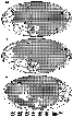
| Figure 1 |
According to recent data, the age of the lower boundary of the Vendian is
estimated at 600
 10 Ma, and that of the upper boundary at 535
1 Ma,
indicating its total duration of about 60 to 65 m.y.
[Semikhatov, 2000; etc.].
By analogy with Phanerozoic glacial events, one can assume that the
Laplandian glacial horizon ("Lower Vendian'') corresponds to a time
interval of about 10-15 m.y. Formation of the Nemakit-Daldyn horizon
("Upper Vendian'') lasted for a few million years to 10-12 m.y. The main,
middle part of the Vendian system sandwiched between the Laplandian and
Nemakit-Daldyn horizons and including the Redkino and Kotlin horizons
and their correlatives approximately corresponds to a time interval of 40 to
45 m.y. Thus, the shortest intervals for which Vendian paleoclimatic
reconstructions might be possible are comparable in duration to Phanerozoic
groups or very long stages (VI and VIII ) and the longest (VII )
are comparable
to Phanerozoic periods.
10 Ma, and that of the upper boundary at 535
1 Ma,
indicating its total duration of about 60 to 65 m.y.
[Semikhatov, 2000; etc.].
By analogy with Phanerozoic glacial events, one can assume that the
Laplandian glacial horizon ("Lower Vendian'') corresponds to a time
interval of about 10-15 m.y. Formation of the Nemakit-Daldyn horizon
("Upper Vendian'') lasted for a few million years to 10-12 m.y. The main,
middle part of the Vendian system sandwiched between the Laplandian and
Nemakit-Daldyn horizons and including the Redkino and Kotlin horizons
and their correlatives approximately corresponds to a time interval of 40 to
45 m.y. Thus, the shortest intervals for which Vendian paleoclimatic
reconstructions might be possible are comparable in duration to Phanerozoic
groups or very long stages (VI and VIII ) and the longest (VII )
are comparable
to Phanerozoic periods.
The situation with the paleogeographic basis for paleoclimatic reconstructions is more complex. At present, more than 15 alternative positions of continents in the Vendian have been published [for a review up to 1990s, see Chumakov, 1992; Kirsechving, 1992a; more recent: Atlas..., 2002; Dalziel and Soper, 2001; Dalziel et al., 1994; Kheraskova et al., 2003; Mossakovsky et al., 1996; Piper, 2000; Scotese, 2002; Scotese and McKerrow, 1990; Smith, 2001; Smith and Pickering, 2003; Young, 1995; and many others]. All these reconstructions differ from each other, occasionally considerably. Sometimes these differences are observable in reconstructions by the same author whose dates of publication are two or three years apart. This situation reflects the vigorous efforts that are made along these lines. It should be expected that an adequate way of tackling this problem will be found in the not-too-distant future because there is already some convergence of the main hypotheses. In this work, the paleoclimatic schemes are based on the paleogeographic reconstructions by Smith and Pickering [[2003] for the Early Vendian (600 Ma) and on tentative ones by Smith [[2001] for the Middle Vendian (580 Ma) and the earliest Lower Cambrian (540 Ma). In agreement with the International Stratigraphic Commission, Smith assigns the Nemakit-Daldyn horizon to the earliest Lower Cambrian; in this paper and in Russia in general, this horizon is regarded as the upper horizon of the Vendian. Smith's reconstructions are based on the most reliable paleomagnetic and paleotectonic data, with an intention to place early Vendian tillites in high and middle latitudes. As will be seen later, this intention could not be completely fulfilled. Nevertheless, these reconstructions appear to be the most successful attempt to date to match paleomagnetic and geological data. These reconstructions will be used here with insignificant changes, which will be explained below.
The limited number of paleoclimatic indicators makes it particularly difficult to identify humid regions in the Vendian. At the same time, regions of cold climate can be delineated with confidence from the episodic development of glacial deposits; regions of warm climate, from carbonate platforms; and regions of arid climate, from the presence of evaporites and carbonate deposits, and occasionally noncarbonate red beds.
We will begin our examination of the Vendian climatic zoning with the youngest and best studied stratigraphic interval and then will look sequentially at the older units.
|
| Figure 2 |
Between the cold zones in the low and partially southern middle latitudes in Nemakit-Daldyn time, there was a hot belt in which carbonate platforms, largely stromatolitic and onkolitic, were forming (the northwestern part of North America, Siberia, Arabia, and the South China block). The major portion of this zone was arid, as indicated by salt, gypsum, and anhydrite strata in Siberia [Khomentovsky, 1990; Zharkov, 1974], Arabia [Brasier and McCarron, 2000; Walter et al., 2000], Iran, and northwestern India [Strauss et al., 2001]. Among the evaporite basins, recognized are two enormous saliferous zones: South Siberian and Iranian-Arabian. The latter zone appeared to have included northwestern Indostan. Sebkha-type gypsum-bearing deposits and imprints of salt and gypsum crystals and anhydrite nodules are known outside these basins as well. All these indicators attest to a warm and hot arid climate in low and partially middle latitudes in Nemakit-Daldyn time.
Carbonate red beds are found in South Africa [Germs, 1995] and Australia [Walter et al., 1995]. Noncarbonate red beds showing evidence of aridity (gypsification, halite films, and desiccation cracks; [Aksenov, 1990]) are known in the Reshma Formation in the East European craton and in northern India [Kumar et al., 2000; Tiwari, 1999]. These redbed, partially carbonate, terrigenous deposits that once occurred between the cold and hot zones at midlatitudes may have formed in semi-arid climate. According to the reconstruction in question, the southernmost polymict redbed sequences lied at 60oS PL (Suvorovo Formation in SW Ukraine). These data appear to support the conclusion that the cold zone of the Southern Hemisphere was restricted to high latitudes, with the midlatitudes occupied by a semi-arid or arid belt.
Analysis of the paleoclimatic reconstruction for the Nemakit-Daldyn stage leads to three essential conclusions. The first crucial conclusion is that this reconstruction is generally consistent with the principal climatic patterns of the Earth and, hence, that Smith's paleoclimatic reconstructions appear to provide an adequate picture of Late Vendian paleogeography. The second conclusion is no less important: the global climate of the Late Vendian was glacial and the biosphere was cold. The third conclusion is that the climatic zoning at the end of the Vendian was asymmetric. This feature, along with the preceding one, renders Late Vendian climate similar to glacial Phanerozoic one.
To the south of the warm zone, in high latitudes in the East European craton and in the Cis-Ural region at that time, the sediments accumulated in the shallow Valdai basin were dominated by bluish-gray fine-grained and thin-bedded clays and siltstones, occasionally enriched in organic matter, and containing remains of Ediacaran faunas and metaphytes. In the marginal parts of the Valdai basin, fine-grained and thin-bedded rocks gave way to coarser grained noncarbonate variegated and red beds with admixture of kaolinite, which indicates erosion of humid weathering crust in source areas. This suggests that the land adjacent to the Valdai basin had a warm and humid climate. Thus, the high latitudes in the Middle Vendian were apparently characterized by a humid and relatively warm climate. This assumption is consistent with the fact that the Middle Vendian shows no evidence of glaciations.
Paleoclimatic data on the Middle Vendian indicate that in that time the Earth's global climate was non-glacial and the biosphere was in a warm state.
In contrast to the "Middle Vendian,'' evidence of glaciations is very widespread in Early Vendian deposits (Figure 2a). The most extensive and at the same time stratigraphically best studied outcrop areas of Early Vendian glacial deposits are the northeastern part of the European craton with the adjacent orogenic zones and Spitsbergen [Chumakov, 1978b, 1990], East Greenland [Hambrey and Spencer, 1987], the Mackenzie Mountains [Narbonne and Atken, 1995], South Africa [Germs, 1995], the Lesser Himalayas [Kumar et al., 2000; Tiwari and Knoll, 1994], Australia [Preiss, 1987, 2000; Walter et al., 2000], South China [Lu et al., 1985; Wang et al., 1998], and some other regions (Figures 1, 2a). The Early Vendian age and origin of glacial deposits in these regions has been amply confirmed by several generations of geologists [for a review see Chumakov, 1978b, 1990; Hambrey et al., 1981]. In addition to those mentioned above, there are numerous occurrences of Vendian glacial deposits whose age or origin is not quite clear [for a review see Evans, 2000].
Stratigraphically and genetically well-studied the Early Vendian glacial deposits occur almost on all large continents and many microcontinents. According to the reconstruction by Smith and Pickering [[2003], many glacial sequences formed in low latitudes. Such a wide distribution indicates a pronounced glacial climate for the Early Vendian and raises the question of the scale of glaciation. Although Smith's original intention in his reconstructions was not to place tillites in low latitudes, he could not completely avoid doing this. He ignored the widely accepted paleomagnetic determinations of low latitudes derived from rocks of the Early Vendian glacial Yerelina Subgroup in Australia, placing this continent in middle and high latitudes of the Northern Hemisphere [Smith, 2001; Smith and Pickering, 2003]. At the same time, Himalayan, Arabian, South African, and Canadian Early Vendian glacial deposits occur in low latitudes in these reconstructions. Similar inferences can be drawn from reconstructions by other workers who sought to place glacial deposits in high and middle paleolatitudes [Khain and Yasamanov, 1987; Young, 1995]. Early Vendian glacial deposits occur in low latitudes also in other aforementioned paleogeographic reconstructions for the Vendian or Early Vendian.
Non-glacial facies in Early Vendian deposits are identifiable only in some individual sequences (e.g., on the Patom Upland). Such sequences are fairly rare because the absence of glacial deposits is, in most cases, accompanied by breaks at the base of the Vendian. The wide spread of breaks appears to have been due to the glacio-eustatic subaerial exposure of many shelves and inland basins. It is quite possible that the very limited occurrence of Lower Vendian non-glacial sequences reflects in part the difficulties inherent in the stratigraphic identification of this interval in non-glacial facies. In the sequences where non-glacial facies are identifiable, there are no clear paleoclimatic indicators, precluding more accurate determination of the climate pattern in these areas.
The present situation allegedly confirms the hypothesis of the Earth's global glaciation in the Early Vendian. In reality, however, there are not so many indisputable proofs of the "snowball Earth'' hypothesis as might appear from the modern geological literature.
This hypothesis was derived from spurious paleomagnetic data, and it is still based on limited paleomagnetic poles. Late Precambrian glacial deposits and their host rocks have yielded only two paleomagnetic determinations of latitudes that meet all criteria for reliability [Evans, 2000]. One of these, relating to the Liantuo Formation in South China (Upper Riphean), indicates middle paleolatitudes. The second determination, from red rocks of the aforementioned glacial Yerelina (Early Vendian) Subgroup in Australia, indicates low paleolatitudes. The paleomagnetism of the Yerelina rocks has been studied many times by various laboratories, and the results are considered very reliable. Some paleomagnetologists, however, express doubts as to the primary nature of this magnetization [Meert and van der Voo, 1995], while some other researchers, as already noted, ignore these measurements [Smith, 2001; Smith and Pickering, 2003]. In addition to the determination from the Yerelina Subgroup, there are two other less reliable low-latitude paleomagnetic measurements and several unreliable ones [Evans, 2000].
Although there are currently no compelling counter-arguments against the "snowball Earth'' hypothesis, serious doubts as to its validity do exist. There are four groups of facts underlying these doubts.
(1) First, the "snowball Earth'' hypothesis disagrees with numerous indications of frequent glacial oscillations and alternation of glacial and inter- glacial events of different ranks in the Early Vendian and Late Riphean [Chumakov, 1978b, 1995a, 1998; Condon et al., 2002; Hambrey et al., 1981; Leather et al., 2002; etc.]. As was noted above, a "snowball Earth'' requires the stable existence of each global ice cover for several million or tens of millions of years. Owing to the enormous albedo of the "snowball Earth,'' a marked increase in the heat balance of the planet's surface would be required each time for the oscillations of glaciers or the termination of glaciation. For the Earth's complete deglaciation, it must increase approximately by 30%. Planetary mechanisms for such dramatic, multiple, and rapid warmings are unknown. Neither can they be related to oscillations of solar radiation.
The inability of the hypothesis of global glaciation to explain glacial oscillations is its main drawback.
(2) The second fact that is inconsistent with the "snowball Earth'' hypothesis is the existence of areas showing gradual transitions from the Upper Riphean to the Lower Vendian and the absence of glacial deposits. An example can be found at the northern and eastern margins of the Patom Upland, where the Lower Vendian consists of the Zherba Formation of cross-bedded glauconitic quartzite-like sandstones and black shales. The Zherba Formation is gradational into its underlying predominantly carbonate deposits of Late Riphean age. On the other hand, it is conformably overlain by "Middle Vendian'' evaporite deposits: karst-related carbonate breccias with traces of leached-out gypsum, variegated marls of the middle part of the Tinnaya Formation and higher up by dolomites and marls of the upper part of the Tinnaya Formation with Nemakit-Daldyn small shell fauna [Khomentovsky et al., 2003]. The absence of any stratigraphically significant break at the base of the Zherba Formation is quite obvious. This is indicated primarily by the gradational contacts between the formations. In the limestones of the Kholych'ya (Upper Riphean) Formation (correlative to the upper part of Chencha Formation) that underly the Zherba Formation, the silt admixture increases gradually from bottom to top. Further upward, there are increasing amounts of layers of thin cross-bedded calcareous siltstones. Still higher upsection, in the member transitional to the Zherba Formation (about 30 m thick), they occur together with layers of sandy dolomites, which become predominant in the upper part of the member, where they alternate with quartz sandstones and siltstones. The conformable nature of the contact is also indicated by the fact that it was observed both along and across the strike of structural-and-facial zones over a distance of hundreds of kilometers. Although some researchers still assume the existence of some break at the base of the Vendian at the northern margin of the upland, they agree that in its central part of the upland the transition between Vendian and Riphean deposits is conformable [Khomentovsky et al., 2003].
The fact that some areas display continuous Upper Riphean-Lower Vendian marine sequences without glacial deposits indicates at least that the glaciation was not total.
(3) This conclusion supports well numerical simulations of glaciations in the
Late Precambrian, indicating that, in the presence of oceans, global
glaciation is physically impossible and that the oceans could not have frozen
between the latitudes
20o
[Hyde et al., 2000];
according to other, more advanced models, even in the winter, the oceans could not
have been
covered by ice persistently between the latitudes
40o-45o
[Poulsen et al., 2002].
Moreover, according to the "snowball Earth'' hypothesis
[Schrag et al., 2002],
the Earth's total glaciation is a consequence of uncontrollable
growth of glaciers up to the equator, after their passage through critical
latitudes, as a result of runaway ice-albedo feedback. Numerical simulation
shows that, in the presence of oceans, this uncontrollable growth does not occur
[Poulsen, 2003].
(4) Finally, paleontology provides evidence of the continuous existence of phytoplankton and, hence, photosynthesis in the Late Precambrian [Fedonkin, 2003]. This suggests that the ocean was not covered by a thick ice layer completely as would be required by the "snowball Earth'' hypothesis.
Doubts as to the reality of the "snowball Earth'' are increased by the growing amounts of data suggesting underestimated paleomagnetic latitudes as determined from sedimentary rocks, particularly red beds. In Paleogene (!) red beds of Central Asia, for instance, paleolatitudes were underestimated by 20o-30o [Bazhenov and Mikolaichuk, 2002]. The possibility of secondary flattening of the NRM vector in much older Late Precambrian sedimentary rocks (in Yrelina Subgroup, for example) was even stronger owing to the loss and redistribution of material in the rocks and the solution and reorientation of clastic grains through protracted static and load metamorphism [Kholodov, 1994]. As a rule, this possibility in the Late Precambrian was ignored on the basis of a few comparisons with measurements on igneous rocks [Evans, 2000]. It is not surprising therefore that, according to some paleomagnetic data, Precambrian continents appear to have stayed in low latitudes for 300-900 m.y. [Chumakov and Elston, 1989; Pisarevsky et al., 2001] - i.e., considerably longer than even the Wilson cycle itself. The primary nature of NRM directions in Precambrian sedimentary rocks is at time not demonstrated conclusively.
There are some other discrepancies between the hypotheses of the Earth's total glaciation, on the one hand, and paleomagnetic and geological evidence, on the other.
According to most recent hypotheses, a necessary condition for a "snowball Earth'' is the tropical position of most continents, ensuring a high temperature, humidity, and very heavy weathering on land, resulting in a strong increase in continental flow and burial of CO 2 and organic carbon in sediments. These processes severely reduce the CO 2 concentration in the atmosphere, initiating a "snowball Earth'' [Schrag et al., 2002]. The presence of land in high latitudes hinders this reduction. At the same time, according to most reconstructions of the positions of continents published in recent years, significant landmasses were located in high latitudes in the Vendian [Atlas..., 2002; Dalziel, 1997; Dalziel and Soper, 2001; Kheraskova et al., 2003; Piper, 2000; Scotese, 2002; Scotese and McKerrow, 1990; Smith, 2001; Smith and Pickering, 2003; etc.].
In the "snowball Earth'' hypothesis, the presence of cap carbonates on glacial deposits and banded iron formations is viewed to result from global events related to rapid deglaciation and to confirm the "snowball Earth.'' However, even though cap carbonates occurred very widely, they did not occur globally. They were shallow-water post-glacial sediments that showed regional facies changes. The South Australian Nuccaleena Formation, which represents a typical cap carbonate and occurs over a large area, consists of paralic and shallow-water nearshore dolomites that give way to shales and sandstones into the more open basin [Preiss, 1987]. Rapid replacement of cap carbonates by sandstones along strike is observable in the Kurgashly Formation in the South Urals [Chumakov, 1992, 1998] and in some other regions. In the South Urals, Spitsbergen, and in many sequences elsewhere, thin carbonate beds are found within marine-glacial deposits [Chumakov, 1992].
The regional nature of Late Precambrian banded iron formations and manganese occurrences associated with glacial deposits is even more obvious [Chumakov, 1992; Young, 2002]. Almost all occurrences and deposits of these ores are confined to volcanic areas, frequently those of rift origin: Tien Shan [Dzholdoshev, 1965]; Southwest and South Africa [Martin, 1965]; northwestern Canada [Yeo, 1981]; West Africa [Trompette, 1981]; Brazil [Ferran, 1982]; South Australia [Preiss, 1987]; California and the Middle Urals [Chumakov, 1992, 1998; etc]. In some cases, iron-rich rocks and iron ores occur between marine-glacial strata (the Tien Shan and Urals) or form the groundmass of these strata (the Tien Shan and Canada [Dzholdoshev, 1965; Eisbacher, 1981; Yeo, 1981]. These facts lead the researchers of Fe and Mn occurrences in glacial sequences to the conclusion that these metals precipitated locally from volcanic fluids in the zone of mixing of fresh glacial and saline sea waters.
Summarizing all doubts related to the "snowball Earth'' hypothesis, one can conclude that it has not yet been proven and needs additional more convincing paleomagnetic evidence that would account in particular for the possibility of flattening of primary NRM vectors in sedimentary rocks. If paleomagnetic data occasionally underestimate the latitude positions of continents, the possibility remains that the two Early Vendian supercontinents (East Gondwana and the nucleus of Rodinia, which incorporated Western Gondwana and Laurasia) were situated at that time somewhat farther from the equator than is now thought. In this case, Early Vendian glaciations would have insignificantly exceeded the scale of maximum Phanerozoic glaciations, and glacial sheets would probably not have crossed the tropical arid zones that are incompatible with their existence.
The "snowball Earth'' hypothesis is yet to account for several geological facts, most notably the frequent glacial oscillations, the existence of Early Vendian non-glacial sequences, the uninterrupted history of photosynthesis, and the regional development of cap carbonates and Fe-Mn occurrences, and to explain the numerical simulation results.
The new stratigraphic, geological, sedimentologic, and paleontological data presented above and the paleoclimatic reconstructions based on them indicate that in the Vendian, as well as in the Phanerozoic, there were two principal types of global climate alternating on the Earth: non-glacial and glacial. The Vendian was marked by two intervals of glacial climate (Laplandian and Nemakit-Daldyn) with a non-glacial interval in-between ("Middle Vendian,'' the Redkino-Kotlin interval, Ediacaran). This alternation was responsible for reorganizations of the climatic zoning, and it changed the state of the biosphere from warm to cold and back.
By using a more refined stratigraphic grid, it was possible to determine that the areas of such antagonistic paleoclimatic indicators as tillites and salts expanded in turns, overlapping each other. To a significant extent, this settles the "Late Precambrian climatic paradox,'' which was widely discussed a few years ago [Chumakov, 1992; Chumakov and Elston, 1989; etc.].
Recent data suggest that the Early Vendian glaciation was not global but
possibly only more extensive than the known Phanerozoic glaciations. This
assumption is more consistent with the above geological, sedimentological,
and paleontological data, as well as simulation results for Late Proterozoic
climates. Considering the larger scale of the Early Vendian glaciation, the
climate during those glaciations appears to have been colder than during
Phanerozoic ones. Accordingly, the area of influence of Early Vendian
glaciations could expand significantly through the more extensive and
distant ice rafting. It is noteworthy, therefore, that all low-latitude
occurrences of the Early Vendian glacial deposits consist mostly of marine-glacial
rocks, whose distribution may have been appreciably wider than that
of ice sheets. For example, it was only locally that Pleistocene ice sheets on
plains reached latitudes 38o-40o; however, evidence of iceberg
rafting in
oceans is observable up to latitude
30o or lower
[Lisitsyn, 1994].
It is quite possible as well, that, in elevated land areas, glaciers could form locally
even in low latitudes.
In the Middle Vendian, the global climate became non-glacial. This is indicated by the absence of reliably recorded glacial deposits and the aforementioned indications of a warm humid climate in the high southern latitudes (Figure 2b). The climatic zonation in the "Middle Vendian'' was apparently weak, and in this respect it was probably somewhat similar to the Mesozoic climatic zonation [Chumakov, 1995b; Chumakov et al., 1995].
In the Nemakit-Daldyn age, the global climate was again glacial, but the glaciation was clearly less extensive than in the Early Vendian, covering only high and some middle latitudes. Its scale may have been comparable to that of the maximum Pleistocene glaciations.
On the whole, if we ignore the not quite clear scale of the Early Vendian glaciation and some climatic features of latitude zones, the climate history of the Vendian was markedly different from the non-glacial climate history of most of the Early Proterozoic and Early to Middle Riphean. The Vendian, along with the Late Riphean, was climatically much more similar to the Phanerozoic, which was also characterized by the alternation of two types of global climate: glacial and non-glacial. It follows, then, that the Earth's present climate system took shape in the Late Riphean or at the end of the Middle Riphean.
Aksenov, E. M., The Vendian of the East European plateform, in The Vendian Sistem, vol. 2, Regional Geology, pp 1-37, Springer-Verlag, Berlin et oth., 1990.
Aksirov, M. M., On the Earth's Evolution, 65 pp., Kabardino-Balkarian Org. of the Znanie Society, Nal'chik, 1989.
Alekseev, A. S., Mass Extinctions in the Phanerozoic, 76 pp., Moscow State University, Moscow, 1998.
Alvarenga, C. J. S., and R. Trompette, Glacially influenced sedimentation in the Later Proterozoic of the Paraguay belt (Mato Grosso, Brazil), Palaeogeogr., Palaeoclim., Palaeoecol., 92, 85-105, 1992.
Alvarenga, C. J. S., and R. Trompette, Upper Proterozoic glacial environment of the border of the Amazonian craton and its evolution towards the adjacent Paraguay belt, Mato Grosso, Brazil, in Earth's Glacial Record, pp. 31-44, Universidade Federal de Mato Grosso, Cuiaba, 1988.
Atlas of Lithologic-Paleogeographic, Structural, Palynspastic, and Geoecological Maps of Central Eurasia, p. 26, maps I-XXXVI, YuGGEO, Almaty, 2002.
Barfod, G. H., F. Albarede, A. H. Knoll, et al., New Lu-Hf and Pb-Pb age constraints on the earliest animal fossils, Earth Planet. Sci. Lett., 201, (1), 203-212, 2002.
Bazhenov, M. L., and A. V. Mikolaichuk, Paleomagnetism of Paleogene basalts from the Tien Shan, Kyrgyzstan: rigid Eurasia and dipole geomagnetic field, Earth Planet. Sci. Lett., 195, (1-2), 155-166, 2002.
Bekker, Yu. R., The Oldest Ediacaran biota of the Urals (in Russian), Izv. Akad. Nauk SSSR, Ser. Geol., (6), 16-24, 1992.
Bertrand-Sarfati, J., A. Moussine-Pouchkine, B. Amard, and A. A. K. Ahmed, 1st Ediacaran fauna found in Western Africa and evidence for an Early Cambrian glaciation, Geology, 23, (2), 133-136, 1995.
Brasier, M. D., G. McCarron, and R. Tucker, New U-Pb zircon dates for the Neoproterozoic Ghubrah glaciation and for the top of the Huqf Supergroup, Oman, Geology, 28, (2), 175-178, 2000.
Cahen, L., Glaciations anciennes et derive des continents, Ann. Soc. Geol. Belg., 86, (1), 79-84, 1963.
Calver, C. R., Isotope stratigraphy of the Ediacarian (Neoproterozoic III) of the Adelaidde Rift complex, Australia, and overprint of water column stratiphication, Precambr. Res., 100, (1-3), 121-150, 2000.
Chumakov, N. M., On the significance of tillite-like rocks for Precambrian stratigraphy, in Papers by Soviet Geologists at Int. Geol. Cong. 1964. Problem 10, pp. 43-58, Nedra, Moscow, 1964.
Chumakov, N. M., International Symposium on Precambrian Glacial Deposits (in Russian), Vestn. Akad. Nauk SSSR, (4), 101-102, 1972.
Chumakov, N. M., A contribution to the stratigraphy of the upper horizons of the Precambrian in the South Urals (in Russian), Izv. Akad. Nauk SSSR, Ser. Geol., (12), 35-48, 1978a.
Chumakov, N. M., Precambrian Tillites and Tilloids, 202 pp., Nauka, Moscow, 1978b.
Chumakov, N. M., Laplandian glacial horizon and its equivalents, in The Vendian System, vol. 2, Regional Geology. protsessy (Stratigraphy and Geological Processes), pp. 191-225, Springer-Verlag, Berlin et oth., 1990.
Chumakov, N. M., The problems of old glaciations (pre-Pleistocene glaciogeology in the USSR), 208 pp., Harwood Academic Publishers, Pennsylvania, 1992.
Chumakov, N. M., Riphean Middle Siberian glaciohorizon of the Riphean (in Russian), Stratigr. Geol. Correlation, 1, (1), 17-28, 1993.
Chumakov, N. M., Climatic oscillations and biotic events (in Russian), Geol. Geofiz., 36, (8), 30-39, 1995a.
Chumakov, N. M., The problem of the warm biosphere, Stratigr. Geol. Correlations, 3, (3), 205-215, 1995b.
Chumakov, N. M., The key section of Vendian glacial deposits in the South Urals (Kurgashly Formation, Krivoluksky graben), in The Urals: Fundamental Problems of Geodynamics and Stratigraphy, pp. 138-153, Nauka, Moscow, 1998.
Chumakov, N. M., Paleoklimatic data in global paleogeographic reconstructions in the Late Precambrian, in Supercontinents in the Geological Evolution of the Precambrian, pp. 43-58, Institute of the Earth's Crust of the Russian Academy of Sciences, Irkutsk, 2001.
Chumakov, N. M., Regularity of global climatic changes according geological date, Stratigr. Geol. Correlations, 12, (2), 2002.
Chumakov, N. M., Conclusion, in Climate in Epochs of Major Biospheric Reorganizations, pp. 251-256 Nauka, Moscow, 2003.
Chumakov, N. M., and Elston, The paradox of Late Proterozoic glaciations at low latitudes, Episodes, 12, (2), 115-119, 1989.
Chumakov, N. M., and M. A. Zharkov, Climate during Permian-Triassic biospheric reorganizations, Stratigr. Geol. Correlations, Paper no. 1, 6, 586-602, 2002.
Chumakov, N. M., and M. A. Zharkov, Climate during Permian-Triassic biospheric reorganizations, Stratigr. Geol. Correlations, Paper no. 2, 4, 451-472, 2003.
Chumakov, N. M., M. A. Zharkov, A. B. Herman, et al., Climatic belts of Mid-Cretaceous Time, Stratigr. Geol. Correlations, 3, (3), 241-260, 1995.
Condon D. J., A. R. Prave, and D. I. Benn, Neoproterozoic glacial-rainout intervals: Observations and implications, Geology, 30, (1), 35-38, 2002.
Crowell, J. C., Pre-Mesozoic ice ages: their bearing on understanding of the climate system, Geol. Soc. Amer. Memoir, 192, 106 p., 1999.
Dalziel, I. W. D., Neoproterozoic-Paleozoic geography and tectonics: Review, hypothesis, environmental speculation, Geol. Soc. Amer. Bull., 109, (1), 16-42, 1997.
Dalziel, I. W. D., and N. J. Soper, Neoproterozoic extension on the Scottish Promontory of Laurentia: Paleogeographic and tectonic implications, J. Geol., 109, 299-317, 2001.
Dalziel, I. W. D., L. H. D. Salda, and L. M. Gahagan, Paleozoic Laurentia-Gondwana interaction and the origin of the Appalachian-Andian mountain system, Geol. Soc. Amer. Bull., 106, 243-252, 1994.
Deynoux, M., J. M. G. Miller, E. W. Domack, et al. (Eds.), Earth's Glacial Record, 266 pp., Cambridge Univ. Press, Cambridge, 1994.
Dzholdoshev, B., Stratigraphy of the Dzhetym-Too Formation within the Dzhetymskoe Iron Deposit, Tien Shan, in Issues of Precambrian and Lower Paleozoic Stratigraphy of Kirghizia, pp. 23-33, Izd. AN Kirgiz. SSR, Frunze, 1965.
Eisbacher, G. H., Late Precambrian tillites of the northern Yukon-Northwest Territories region, Canada, in Earth's Pre-Pleistocene Glacial Record, edited by M. J. Hambrey, W. B. Harland, N. M. Chumakov, et al., pp. 724-727, Cambridge Univ. Press, Cambridge, 135-139, 1981.
Evans, D. A. D., Stratigraphic, geochronological, and paleomagnetic constraints upon the Neoproterozoic climatic paradox, Amer. J. Sci., 300, 347-433, 2000.
Fedonkin, M., The origin of the Metazoa in the light of the Proterozoic fossil record, Paleontological Res., 7, (1), 9-41, 2003.
Ferran, Axel de, Vue d'ensemble sur les mineralisations sedimentaires du Tardi-Proterozoique brasilien, Chronique de la Recherche Miniere, (466), 5-39, 1982.
Germs, G. J. B., The Neoproterozoic of the southwestern Africa, with emphasis on platform stratigraphy and paleontology, Precambr. Res., 73, (1-4), 137-151, 1995.
Gorokhov, I. M., A. Siedlecka, D. Roberts, et al., Rb-Sr dating of diagenetic illite in Neoproterozoic shales, Varangian Peninsula, North Norway, Geol. Mag., 138, (5), 541-562, 2001.
Guan, B., W. U. Ruitang, M. J. Hambrey, and G. Wuchen, Glacial sediments and erosional pavements near the Cambrian-Precambrian boundary in western Henan Province, China, J. of Geol. Soc. London, 143, 311-323, 1986.
Hambrey, M. J., W. B. Harland, N. M. Chumakov, et al. (Eds.), Earth's Pre-Pleistocene Glacial Record, 1004 pp., Cambr. Univ. Press., Cambridge, 1981.
Hambrey, M. J., and A. M. Spencer, Late Precambrian glaciation of central East Greenland, Geoscience, 19, 53 p., 1987.
Harland, W. B., Evidence of Late Precambrian glaciation and its significance, in Problems in Palaeoclimatology, edited by A. E. M. Nairn, pp. 119-149, 179-184, 1964.
Harland, W. B., M. J. Hambrey, and P. Waddams, Vendian geology of Svalbard, 150 pp., Norsk Polar Inst., Skrifter 193, 1993.
Hoffman, P. F., and D. P. Schrag, The snowball Earth hypothesis: testing the limits of global change, Terra Nova, 14, (3), 129-155, 2002.
Hyde, W. T., T. J., Crowley, S. K. Baum, and W. R. Peltier, Neoproterozoic "snowball Earth'' stimulations with a coupled climate/ice-sheet model, Nature, 405, (6785), 425-429, 2000.
Khain, V. E., and N. A. Yasamanov, The Paradox of Late Proterozoic glaciations and continental drift (in Russian), Vestn. Mosk. Univ., Ser. 4, Geol., (1), 15-25, 1987.
Kheraskova, T. N., A. N. Didenko, V. A. Bush, and Yu. A. Volozh, The Vendian - Early Paleozoic history of continental margin of Eastern Paleogondwana, Paleoasian Ocean, and Central Asian Foldbelt, Russian J. Earth Sciences, 5, (3), 165-184, 2003.
Kholodov, V. N., The L. I. Salop - G. Gilluli curve: A reality or an artifact? (in Russian), Litol. Polezn. Iskop., (2), 49-65, 1994.
Khomentovsky, V., The Vendian of the Siberian platform, in The Vendian System, vol. 2, Regional Geology, pp. 102-183, Springer-Verlag, Berlin et oth., 1990.
Khomentovsky, V. V., A. A. Postnikov, G. A. Karlova, et al., The Vendian of the Baikal-Patom Upland, Sibiria, Stratigr. Geol. Correlations, 2003.
Kirsechvink, J., A Paleogeographic Model for Vendian and Cambrian Time, in The Proterozoic Biosphere, A Multidisciplinary Study, pp. 567-582, Cambridge Univ. Press., Cambridge, 1992a.
Kirsechvink, J. A., Late Proterozoic Low-Latitude Global Glaciation: the Snowball Earth, in The Proterozoic Biosphere, A Multidisciplinary Study, pp. 51-52, Cambridge Univ. Press., Cambridge, 1992b.
Kiselev, V. V., and V. G. Korolev, Precambrian and Lower Paleozoic Paleotectonics of the Tien Shan, 183 pp., Ilim, Frunze, 1981.
Klitin, K. A., Baikal orogeny and tillite-like conglomerates in Caledonide sequences of Europe and Greenland (in Russian), Dokl. Akad. Nauk SSSR, 163, (3), 702-705, 1965.
Knoll, A. H., Learning to tell Neoproterozoic time, Precambr. Res., 100, (1-3), 3-20, 2000.
Kumar, G., R. Shanker, V. K. Mathur, and P. K. Maithy, Maldeota Section, Mussoorie Syncline, Krol Belt, Lesser Hymalaya., India: A Candidate for Global Stratotype Section and Point for Terminal Proterozoic System, Terminal Proterozoic System, 13-th Circular 2000 IWGS: Subcommission on terminal Proterozoic System, 9-19, 2000.
Leather, J., P. A. Allen, M. D. Brasier, and A. Cozzi, Neoproterozoic snowball earth under scrutiny: Evidence from the Fig glaciation of Oman, J. Geol., 30, (10), 891-894, 2002.
Lisitsyn, A. P., Ice Sedimentation in the World Ocean, 448 pp., Nauka, Moscow, 1994.
Lu, S., Z. Gao, and W. Lin, Sinian ice age and glacial sedimentary facies--areas in China, Precambr. Res., 29, 53-63, 1985.
Malcuit, R. J., and R. R. Winters, The Late Proterozoic glaciations: possible product of the evolution of the Earth-Moon system, Abstracts, 26th Congress Geol. Intern. Paris, II, 600, 1980.
Martin, H., The Precambrian Geology of South West Africa and Namaqualand, 159 pp., Cape Town Univ., 1965.
Martin, M. W., D. V. Grazhdankin, S. A. Bowring, et al., Age of Neoproterozoic bilatarian body and trace fossils, White Sea, Russia: Implication for Metaxoan evolution, Science, 288, 841-845, 2000.
Maslov, A. V., E. Z. Gareev, M. T. Krupenin, et al., Lithologic, lithochemical, and geochemical paleoclimate indicators (in Russian), Litol. Polezn. Iskop, (5), 512-528, 2003.
Meert, J. C., and R. van der Voo, The Neoproterozoic (1000-540 Ma) glacial intervals: No more snowball earth? Reply, Earth Planet. Sci. Lett., 131, 123-125, 1995.
Meert, J. C., and C. M. Powell, Assembly and break-up of Rodinia: introduction to the special volume, Precambr. Res., 110, 1-8, 2001.
Monin, A. S., and Yu. A. Shishkov, Istoriya klimata (Climate History), 407 pp., Gidrometioizdat, Leningrad, 1979.
Mossakovsky, A. A., B. M. Pushcharovsky, and S. V. Ruzhentsev, Spatiotemporal relationships of structures of the Pacific and Indo-Atlantic types in the Late Precambrian and Vendian (in Russian), Dokl. Akad. Nauk, 350, (6), 799-802, 1996.
Myrow, P. M., Neoproterozoic rocks of the Newfoundland Avalon Zone, Precambr. Res., 73, (1-4), 123-136, 1995.
Myrow, P. M., and A. J. Kaufman, A newly discovered cap carbonate above Varangian-age glacial deposits in Newfoundland, Canada, J. Sediment. Res., 69, (3), 784-793, 1999.
Narbonne, G. M., and J. D. Aitken, Neoproterozoic of the Mackenzie Mountains, northwetern Canada, Precambr. Res., 73, (1-4), 101-121, 1995.
Narbonne, G. M., and J. G. Gehling, Life after snowball: the oldest complex Ediacaran fossils, Geology, 31, (1), 27-30, 2002.
Piper, J. D. A., The Neoproterozoic Supercontinent: Rodinia or Paleopangaea?, Earth Planet. Sci. Lett., 176, 131-146, 2000.
Pisarevsky, S. A., Z. X. Li, K. Grey, and M. K. Stevens, A palaeomagnetic study of Empress 1A, a stratigraphic drillhole in the Officer Basin: evidence for a low-latitude position of Australia in the Neoproterozoic, Precambr. Res, 110, (1-4), 93-108, 2001.
Poulsen, C. J., Absence of a runaway ice-abedo feedback in the Neoproterozoic, Geology, 31, (6), 473-476, 2003.
Poulsen, C. J., R. T. Pierrehumbert, and R. L. Jacob, Impact of oceanic dynamics on the simulation of the Neoproterozoic "snowball Earth,'' Geophys. Res. Lett., 28, (8), 1575-1578, 2002.
Preiss, W. V., (Compiler), The Adelaide Geosyncline--Late Proterozoic stratigraphy, sedimentation, palaeontology and tectonics, Bull. Geol. Surv. Aust., 53, p. 438, 1987.
Preiss, W. V., The Adeaide Geosyncline of South Australia and its significance in Neoproterozoic continental reconstruction, Precambr. Res., 100, (1-3), 21-63, 2000.
Rampino, M. R., Tillites, diamictites, and ballistic ejecta of large impacts, J. Geol., 102, (4), 439-456, 1994.
Schermerhorn, L. J. G., Late Precambrian mixtites: glacial and/or nonglacial?, Amer. J. Sci., 274, 673-824, 1974.
Schrag, D. P., R. A. Berner, P. F. Hoffman, and G. P. Halverson, On the initiation of a snowball Earth, Geochemistry, Geophysics, Geosystems, G 3, An Electronic J. Earth Sci., 3, (6), 1-21, 2002.
Scotese, C. R., Paleomap project, 2002. http://www. scotese
Scotese, C. R., and W. S. McKerrow, Revised World maps and introduction, Paleozoic Palaeogeography and Biogeography, Geol. Soc. Memoir, (12), 1-21, 1990.
Semikhatov, M. A., Refining radiometric ages for the lower boundaries of the Upper Riphean, Vendian, Upper Vendian, and Cambrian, Supplement 4, in Supplements to the Stratigraphic Code of Russia, pp. 95-107, All-Russian Geological Institute, St. Petersburg, 2000.
Sheldon, R. P., Model of Precambrian glaciation related with evolution of exogenic environments from Proterozoic to Phanerozoic history, 6th Internation. Sympos. on phosphorites, Kunmin, 2, Peking, pp. 227-243, 1982.
Smith, A. G., Paleomagnetically and tectonically based global maps for Vendian to Mid-Ordovician time, in The Ecology of the Cambrian Radiation, pp. 11-46, Columbia Univ. Press, N. Y., 2001.
Smith, A. G., and K. T. Pickering, Oceanic gateways as a critical factor to initiate icehouse Earth, J. Geol. Soc. London, 160, pt. 3, 337-340, 2003.
Sokolov, B. S., Essays on the Advent of the Vendian System, 156 pp., KMK Ltd., Moscow, 1998.
Strauss, H., D. M. Banerjee, and V. Kumar, The sulfur isotopic composition of Neoproterozoic to early Cambrian seawater--evidence from the cyclic Hanseran evaporites, NW India, Chem. Geol., 175, (1-2), 17-28, 2001.
Tiwari, M., Organic-walled microfossils from the Chert-phosphorite Member, Tal Formation, Precambrian-Cambrian Boundary, India, Precambr. Res., 97, (1-2), 99-113, 1999.
Tiwari, M., and H. Knoll, Lage acanthomorphic acritarchs from the Infrakrol Formation of the Lesser Himalaya and their stratigraphic significance, J. Himalaya Geol., 5, 193-201, 1994.
Trompette, R., Late Precambrian tillite of the Volta Basin and the Dahomeyides Orogenic belt (Benin, Gana, Niger, Togo and Upper Volta), in Earth's Pre-Pleistocene Glacial Record, edited by M. J. Hambrey, W. B. Harland, N. M. Chumakov, et al., pp. 135-139, Cambridge Univ. Press, Cambridge, 1981.
Trompette, R., Geology of Western Gondwana (2000-500 Ma) Pan-African-Brasiliano Aggregation of South America and Africa, A. A. Balkema, 350 pp., Brookfield, Rotterdam, 1994.
Trompette, R., Neoproterozoic (~600 Ma) aggregation of Western Gondwana: a tentative scenario, Precambr. Res., 82, 101-112, 1997.
Vidal, G., Micropaleontology and biostratigraphy of the Upper Proterozoic and Lower Cambrian sequences in East Finnmark, northern Norway, Norway Geol. Unders. Bull., 3, (362), 53 pp., 1981.
Vidal, G., and M. Moczydlowska, The Neoproterozoic of Baltica--stratigraphy, paleobiology and general geological evolution, Precambr. Res., 73, (1-4), 197-216, 1995.
Walter, M. R., J. J. Veevers, C. R. Calver, and K. Grey, Neoproterozoic stratigraphy of the Centralian Superbasin, Australia, Precambr. Res., 73, 173-195, 1995.
Walter, M. R., J. J. Veevers, C. R. Calver, P. Gorjan, and A. C. Hill, Dating the 840-544 Ma Neoproterozoic interval by isotopes of strontium, carbon, and sulfur in seawater, and some interpretative models, Precambr. Res., 100, 371-433, 2000.
Wang, X., B. Erdtmann, C. Xiaohong, and M. Xiaodong, Intergrated sequence-, bio- and chemo-stratigraphy of the terminal Proterozoic to Lowermost Cambrian "black rock series'' from central South China, Episodes, International Geosciece Newsmagazine, 21, (3), 178-189, 1998.
Williams, G. E., Late Precambrian glacial climate and the Earth's obliquity, Geol. Mag., 112, 441-465, 1975.
Yeo, G. M., The Late Proterozoic Rapitan Glaciation in the Northern Cordillera, Geol. Surv. Canada, Paper 81-10, 25-46, 1981.
Yin, L. M., and B. D. Guan, Organic-walled microfossils of Neoproterozoic Dongjia, Lushan Country, Henan Province, North China, Precambr. Res., 94, (1-2), 121-137, 1999.
Young, G. M., Are Neoproterozoic glacial deposits preserved on the margins of Laurentia related to the fragmentation of two supercontinents?, Geology, 23, (2), 153-56, 1995.
Young, G. M., Stratigraphic and tectonic settings of Proterozoic glaciogenic rocks and banded iron-formations: relevance to the snowball Earth debate, J. African Earth Sci., 35, (4), 451-66, 2002.
Zhang, Y., L. Yin, S. Xiao, and A. H. Knoll, Permineralised fossils from the terminal Proterozoic Doushantion Formation South China, Paleontol. Soc. Mem., 72, (4), 52 pp., 1998.
Zharkov, M. A., History of Paleozoic Salt accumulation, 390 pp., Springer-Verlag, Berlin et oth., 1981.