RUSSIAN JOURNAL OF EARTH SCIENCES, VOL. 21, ES4003, doi:10.2205/2021ES000767, 2021
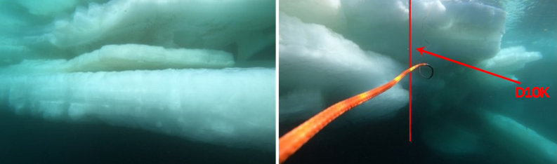
Figure 5. Examples of photographs of the underwater relief of ice formation numbered 7 taken using a remotely controlled underwater vehicle. The straight vertical rod on the right photo, indicated by the red arrow, is submerged in the water in order to evaluate the thickness of the layers of ice under water. The length of the rod is 2.35 m. A red auxiliary rope is seen in the foreground.

![]()
Citation: Morozov P. A., A. I. Berkut, P. L. Vorovsky, F. P. Morozov, S. V. Pisarev (2021), Measuring sea ice thickness with the LOZA georadar, Russ. J. Earth Sci., 21, ES4003, doi:10.2205/2021ES000767.
Copyright 2021 by the Geophysical Center RAS.
Generated from LaTeX source by ELXfinal, v.2.0 software package.