RUSSIAN JOURNAL OF EARTH SCIENCES, VOL. 20, ES5005, doi:10.2205/2020ES000715, 2020
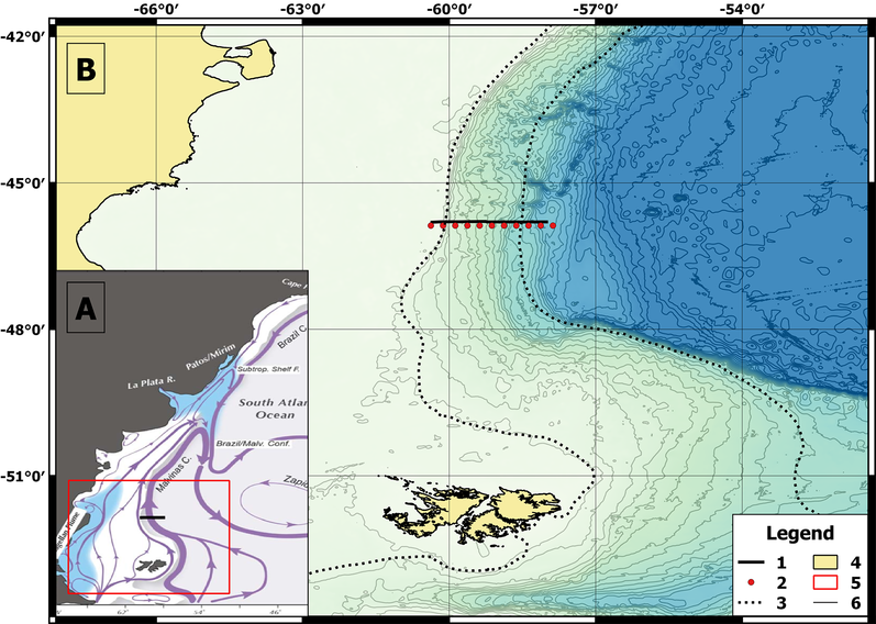
Figure 1. The study site. A: Circulation near the study site. The scheme was adopted from [Combes and Matano, 2014]. B: Transect location. The legend notations are: 1. Transect; 2. The grid points of the World Ocean Atlas 2013; 3. The M/FC border based on the previous studies; 4. Land; 5. Location of figure on the general map is shown in the inset; 6. Isobaths are drawn with an interval of 200 m.

![]()
Citation: Krechik V. A. (2020), The upper layer of the Malvinas/Falkland current: Structure, and transport near 46\deg S in January 2020, Russ. J. Earth Sci., 20, ES5005, doi:10.2205/2020ES000715.
Copyright 2020 by the Geophysical Center RAS.
Generated from LaTeX source by ELXfinal, v.2.0 software package.