
A. G. Iosifidi, A. N. Khramov
All-Russia Petroleum Research and Exploration Institute (VNIGRI), Saint Petersburg, Russia
V. Bachtadse
Department for Earth and Environmental Sciences, Geophysics Section, Ludwig-Maximilians University, Munich, Germany
The recent years have been marked by a growing interest in the study of Vendian and Early Paleozoic rocks. In our opinion, this has been associated with a significant progress in the methods and techniques of paleomagnetic studies and with the growing interest in the geological history of the Earth at the Vendian-Cambrian boundary which marked the time of the significant reconstruction of both the biosphere and the geodynamics of the Earth crust. At the end of the last century the paleomagnetic data available for the major tectonic plates of the Earth were generalized. The examples are the papers of Meert and Van der Voo [1994] and Torsvik et al. [1996]. These papers proved a necessity for expanding a paleomagnetic data base for the Vendian and Early Cambrian time for the major tectonic plates, including the East European platform [Glevasskaya et al., 2000; Elming et al., 2004, submitted; Iglesias et al., 2004, submitted; Popov et al., 2002, 2004, submitted]. Some of these and earlier data [Bylund, 1994; Piper, 1981] produce a group of paleomagnetic poles which do not agree with the Vendian segment of the trajectory for the apparent polar wander path (APWP) for the East European Platform suggested by Torsvik et al. [1996] and by Smethurst et al. [1998]. To verify this situation a new study of the Vendian rocks exposed at the southwestern slope of the Ukrainian Shield (Podolia, Ukraine) was carried out. The results of this work are discussed in this paper.
|
|
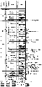
| Figure 1 |
|
| Figure 2 |
 14 Ma, and also
40 Ar/
39 Ar datings
[Elming et al., 2004, submitted]:
580
9 Ma and 561
13 Ma. These age estimates allow one to believe
that the
Vendian sedimentary rocks of Podolia are at least not older than 560-570 Ma
and not younger
than 545 Ma (Vendian-Cambrian boundary) and embrace the time interval of 15-25 Ma.
14 Ma, and also
40 Ar/
39 Ar datings
[Elming et al., 2004, submitted]:
580
9 Ma and 561
13 Ma. These age estimates allow one to believe
that the
Vendian sedimentary rocks of Podolia are at least not older than 560-570 Ma
and not younger
than 545 Ma (Vendian-Cambrian boundary) and embrace the time interval of 15-25 Ma.
In the course of the field work in 1995 and 1999 oriented rock samples were collected from all stratigraphic units of the Podolian Vendian rocks. The sampling areas are shown in Figures 1 and 2. The sample collection was subdivided into groups in terms of the rock formations, following the conventional stratigraphic subdivision of the Podolian rocks [Sokolov and Fedonkin, 1985; Velikanov, 1990; Velikanov et al., 1983]. Samples were collected following the stratigraphic sequence of the rocks at the intervals of 0.1 m to 2 m of their thickness.
Ranked as the Volynian Series were the oldest rocks identified as the Grushka Formation. These are coarse clastic rocks (gravelites and conglomerates) in the lower part of the sequence and gray argillaceous rocks (argillite and aleurolite) in its upper part. The upper rocks of the Grushka Formation are exposed also in the area north of the Podolian rocks, in the Goryn R. Valley, where they are represented by brown argillite, siltstone, and grayish sandstone. The samples of these rocks were collected in outcrops 17 and 18 (Figure 2) in the vicinities of the Putrintsa and Tashka villages, the average sampling site coordinates being j=50.2o and l=27.0o.
The Mogilev-Podolian rock series includes the Mogilev, Yaryshev, and Nagoryanka Formations. The Mogilev Formation includes the Mogilev, Yaryshev, and Nagoryanka formations. The Mogilev Formation includes (upward) the Olchedaev beds (composed mainly of coarse and inequigrained arkose sandstone and gravelite), up to 20-25 m thick, the Lomozov beds, composed of alternating dark gray argillite and fine-grained sandstone beds, up to 15-20 m thick, and the Yampol beds of light-gray oligomictic sandstone, varying from 15 m to 20 m in thickness. The Lomozov beds can be classified as the oldest rocks, showing Metazoa imprints [Sokolov and Fedonkin, 1985; Velikanov, 1990; Velikanov et al., 1983]. The samples of the Mogilev Formation rocks were collected in outcrops 1-8 in the vicinities of the Grushka, Vinoz, Bukatinka, Iraklievka, and Borshovy Yar villages, the average coordinates of the sampling sites being j=48.6o and l=27.8o, in Figures 1, 2. The sampling interval varied from 0.2 m to 2.0 m.
The Yaryshev Formation is composed (upward) of the Lyadov, Bernashev, Bronnitsy, and Zinkov beds. The Lyadov beds consist of greenish gray and brown thin-layered slightly micaceous argillite and silty argillite. The Bernashev beds consist of three members. The lower member (10 m thick) is composed of sandstone and siltstone. The intermediate member, up to 7 m thick, consists of dark gray, gray, and green argillite, and the upper member, 5 m thick, is composed of dark gray sandstone. The average thickness of the Bernashev beds is 20 m. The Bronnitsy beds consist of tuffaceous argillite and pelitic tuffite of chocolate-brown and light green, often mottled, color. The upper parts of these beds include several layers of bentonite clay (less than 1 cm thick) and grade slowly to fine micaceous argillite. The thickness of the Bronnitsy beds varies from 15 m to 20 m. The Zinkov beds are represented by greenish- and bluish-gray and grayish-green argillite and siltstone. These beds are as thick as 25-30 m [Sokolov and Fedonkin, 1985; Velikanov, 1990; Velikanov et al., 1983]. The samples of the Yaryshev Formation rocks were collected at Sites 3, 9, and 10 in the vicinities of the Bernashevka and N. Olchedaev villages, their average coordinates being j=48.6o and l=27.6o (see Figures 1 and 2). The sampling interval varied from 0.1 m to 1.5 m.
The Nagoryanka Formation combines the Dzhurdzha and Kallyusa beds. The Dzhurdzha beds are represented by greenish light gray inequigranular sandstones, often interbedded by greenish-gray argillite and siltstone. These beds vary from 20 m to 25 m in thickness. The Kallyusa beds are represented by a sequence of dark-gray thin-laminated argillite up to 50 m thick. These rocks contain phosphorite concretions [Sokolov and Fedonkin, 1985; Velikanov, 1990; Velikanov et al., 1983]. The rock samples of the Nagoryanka Formation were collected in outcrops 10 to 13 in the vicinities of the Bernashevka, Timkov, and Antonov Yar villages at the average coordinates of j=48.74o and l=27.25o, in Figures 1 and 2. The sampling interval was 1-2 m.
The Kanilov rocks resting on the underlying rocks with a stratigraphic unconformity are represented by four sedimentation cycles each cycle corresponding to a respective formation, namely, the Danilov, Zharnov, Krushanov, and Studenitskaya formations following one another upward.
The Danilov Formation consists of interbedded fine- to medium-grained siltstones and argillite, often variegated. This formation has been subdivided into the Pilipov and Shebutinets beds, its total thickness being 34-40 m [Sokolov and Fedonkin, 1985; Velikanov, 1990; Velikanov et al., 1983]. The samples of the Danilov rocks were collected in outcrops 12 and 13 near the Timkov and Sokolets villages (the average coordinates being j=48.79o, l=27.08o ), in Figures 1 and 2. The sampling interval was 1 m and 2 m.
The Zharnovsky Formation is composed of coarse-grained sandstone at the base, which are overlain by interbedded medium- and fine-grained sandstone, argillite, and siltstone. This formation has been subdivided into the Kuleshev and Staraya Ushitsa beds totaling 30-35 m in thickness [Sokolov and Fedonkin, 1985; Velikanov, 1990; Velikanov et al., 1983].
The Krushanov Formation consists of greenish-gray and white sandstones. The upper part of the formation includes red sandstones, siltstones, and argillite. This formation has been subdivided into the Krivchan and Durnyakov beds. Its total thickness varies from 57 m to 62 m [Sokolov and Fedonkin, 1985; Velikanov, 1990; Velikanov et al., 1983]. The samples of the Krushanov rocks were collected in outcrop 14 near the Krivchany Village at the average coordinates of j=48.6o and l=27.07o, in Figures 1 and 2. The sampling interval was 1-2 m.
The Studenitskaya Formation is represented by interbedded coarse- and fine-grained sandstones, argillites, and siltstones. This formation has been subdivided into the Polivanovo and Komarovo beds totaling up to 70 m in thickness. Samples were collected from the upper part of the formation in outcrop 15 near the Kitaigorod Village with the coordinates of j=48.7o and l=26.5o in Figures 1 and 2. The sampling interval was 0.1 m to 0.5 m.
The rocks of the Kanilov Series grade upward without any interruption to the rocks of the Baltic Series, which is represented in the Podolia region by three formations, Okunets, Khmelnitsky, and Zbruch, the rocks of the latter being found only in boreholes. The Okunets Formation is composed of gray, greenish, and brownish argillites and siltstone lenses. The Khmeltitsky Formation consists of dark-gray, gray, and greenish-gray argillites, interbedded by gray siltstone layers [Sokolov and Fedonkin, 1985; Velikanov, 1990; Velikanov et al., 1983]. Some geologists believe that the Baltic rock series (Okunets and Khmelnitsky Formations) may include the Vendian-Cambrian boundary Velikanov, 1990. The samples of the Baltic Series rocks were collected at outcrop 15 near the Kitaigorod Village, j=48.7o, l=26.5o, in Figures 1 and 2. The sampling interval was 0.1-0.5 m.
Where the samples of the same formation were collected from different outcrops (usually not farther than 50 km from one another), their average geographic coordinates were used to calculate average paleomagnetic poles for a respective formation.
The collected oriented lumps were sawed into cubes, 2 22 cm in size.
Each lump was
represented by 2-5 samples. The total number of the cubes was 1250 derived from 386
lumps.
The laboratory paleomagnetic measurements and the processing of the results were
performed
using conventional techniques. Most of the samples were studied at the laboratories
of the
Department of Paleomagnetic Reconstructions in the All-Russia Petroleum Research
and
Exploration Institute (VNIGRI) and in the Department for Earth and Environmental
Sciences,
Geophysics Section, Ludwig-Maximilians University, Munich, Germany. The components
of
natural remanent magnetization were identified by the method of stepwise thermal
demagnetization using the measuring instruments placed into 5-layer Permalloy screens
of the
VNIGRI construction or into Schoenstedt TSD-1 screens (USA). Measurements
J n were conducted with the use
of rock generators JR-4 and JR-5 (Agico, Czech Republic) and criogenic magnetometer
2G (USA).
The chemical transformations that occurred in the course of thermal cleaning were
controlled by measuring magnetic
susceptibility after each heating interval using a KLY-2 Kapp bridge (Agico, Czech
Republic).
22 cm in size.
Each lump was
represented by 2-5 samples. The total number of the cubes was 1250 derived from 386
lumps.
The laboratory paleomagnetic measurements and the processing of the results were
performed
using conventional techniques. Most of the samples were studied at the laboratories
of the
Department of Paleomagnetic Reconstructions in the All-Russia Petroleum Research
and
Exploration Institute (VNIGRI) and in the Department for Earth and Environmental
Sciences,
Geophysics Section, Ludwig-Maximilians University, Munich, Germany. The components
of
natural remanent magnetization were identified by the method of stepwise thermal
demagnetization using the measuring instruments placed into 5-layer Permalloy screens
of the
VNIGRI construction or into Schoenstedt TSD-1 screens (USA). Measurements
J n were conducted with the use
of rock generators JR-4 and JR-5 (Agico, Czech Republic) and criogenic magnetometer
2G (USA).
The chemical transformations that occurred in the course of thermal cleaning were
controlled by measuring magnetic
susceptibility after each heating interval using a KLY-2 Kapp bridge (Agico, Czech
Republic).
The magnetic minerals were identified as NRM carriers studying their normal and saturation magnetization versus temperature using a VFTB (Variable Field Translation Balance) and the Lowrie method [Lowrie, 1990]. The samples of two pilot collections (each collection consisting of 50 samples) were demagnetized at the Lamont-Doherty Observatory, USA, by M. Smethurst and at the Paleomagnetic Laboratory of the Tectonic Special Research Center in Perth, Australia, by S. Pisarevskiy. As a result of analyzing these data, the NRM components were identified using orthogonal projections [Zijderveld, 1967]. The directions of these components were computed using the least squares method [Kirschvink, 1980]. All of these operations and the graphic representation of the results were performed using computer programs available [Enkin, 1994; Torsvik and Smethurst, 1999].

|
| Figure 3 |
10-3 SI units.
The gray rocks yielded the values of (0.1-2) mA m-1 and (0.2-0.4)10-3 SI units.
Figure 3 shows the examples of studying the samples
of various
rocks using a VFTB equipment. Sample 58 (gray siltstone, Okunets Formation of the
Baltic
Series, outcrop 15) showed a remanence coercivity field of 35 mT (Figure 3A)
and a Curie
temperature of 580o C (Figure 3B), these values suggesting magnetite.
Sample 222 (grayish green
siltstone, Krushanovo Suite, outcrop 14) showed a remanence coercivity field of
68 mT (Figure 3A)
and the Curie temperatures of 650o C and 435o C (Figure 3B),
these results suggesting the
existence of two magnetic phases. The low-temperature phase seems to be associated
with a
secondary mineral, maghemite. The second magnetic mineral of this sample seems to
be
hematite, which is proved by the unblocking temperatures recorded during the thermal
cleaning
of this sample. Sample 110 (dark-brown argillite, Bronnitsy beds, Yaryshev Formation,
outcrop
11) showed a remanence coercivity field of 147 mT (Figure 3A) and a Curie
temperature of
666o C (Figure 3B), which suggest the mineral to be hematite. The
examples of using the Lowrie method
[Lowrie, 1990]
are presented in Figures 3C and 3D. The development of normal remanent
magnetization (Isothermal Remanent Magnetization (IRM)) along the three axes (1.4T
along the
X, 0.3T along the Y, and 0.1T along the Z axes) and its further destruction by the
temperature
allows one to distinguish the soft, intermediate, and hard components of magnetic
agents and to
estimate their contributions to the total magnetization. Sample 90-7 (glauconite-quartz
sandstone, Baltic Series, outcrop 15) includes a hard component with a unblocking
temperature
of 580oC, which makes the basic contribution to the natural remanent
magnetization and seems
to be associated with the content of magnetite in the rock. Sample 114-3 (dark-gray
argillite,
Bronnitsy beds, Yaryshev Formation, outcrop 11) has two significant components with
the
unblocking temperatures of 560oC and 660oC, this suggesting
the presence of hematite and,
possibly, magnetite. The results of our thermal magnetic analysis, combined with
the results of
stepwise temperature demagnetization, suggest that the magnetite and hematite are
the main
magnetic carriers of highly coercitive NRM components.
The stepwise temperature demagnetization of the collected rock samples revealed seven components of natural remanent magnetization. These components were identified by way of analyzing the orthogonal projections of the NRM components in accordance with their unblocking temperatures and directions, and were denoted as A, B, C, D1, D2, P1, and P2. These NRM components were identified during the first phase of the analysis inside each of the studied rock formations, the components of similar directions being then combined over the whole rock sequence by way of averaging their paleomagnetic poles. It should be noted that the component composition of the rocks has a complex character. In many cases (usually in the cases of gray and greenish-gray rocks) the samples collected from the same lump show a varying assembly of NRM components, both in terms of unblocking temperatures and directions, this suggesting the operation of secondary processes which had caused the remagnetization of some rock types. In this case NRM components were identified using the clusters of the same directions in each rock sequence and their statistical significance. Since the rocks lie almost horizontal and their NRM components vary insignificantly in the geographic and stratigraphic coordinates, all data are reported here in the geographic coordinates.

|
| Figure 4 |

|
| Figure 5 |
The second medium- and high-temperature B component was identified in the temperature range of 300-600o C in the red rocks (Figure 4, 114-1 and Figure 5, 242v1) and at the temperatures of 300-535o C and 580o C in the gray rocks. The B component was identified in all rock sequences, being the terminal one in the gray rocks. This component is a bipolar one in the red rocks of the Krushanov Formation, although showing a negative reversal test [McFadden and McElhinny, 1990]. The distribution of the B component in the rock formations is shown in Figure 5b. The next unipolar component C was identified mainly in gray rocks in the temperatures ranges of 300-500o C and 550-600o C, and also in the red rock samples collected from the Zharnovsky Formation (Figure 4, Sample 190-3). The distribution of the C component directions is shown in Figure 5, the average directions of the individual rock suites being presented in Table 1. The D1 and D2 components were identified both in the old rock suites (Grushka, Mogilev, and Yaryshev), and in the younger formations (Krushanov, Okunets, and Khmelnitsky). The D1 and D2 components were identified in the range of 250-500o C (Sample 6V, Mogilev Formation, Figure 4) and in the ranges of 300-580o C and 600-670o C of the gray rocks (Sample 244-1, Baltic rock series, Figure 4). The D1 (Baltic Series) and D2 (Krushanov Formation) components are bipolar ones, showed a positive reversal test [McFadden and McElhinny, 1990] and were ranked as class C. The rocks of the Baltic Series showed the angle between the average directions of the direct and reverse polarities of the D1 component to be 13.8o, with the critical angle of 15.8o, the respective values being 12.0o and 16.4o for the D2 component of the Krushanov rocks. The distribution of the D1 and D2 component directions is shown in Figure 5. The average directions for the rocks in all rock suites are given in Table 1. It should be noted that the C, D1, and D2 components have been identified in the gray rocks. The next two components, P1 and P2, are high-temperature ones, ranging in the temperature intervals of 500-570o C, 600oC and 600-670oC, 690oC. See samples 6V, 114-1, 124N1, 185-1, 190-3, and 244-1 in Figure 4. Most of the rock components are bipolar, show a positive reversal test, and have been ranked as Class C [McFadden and McElhinny, 1990]. The distribution pattern of the P1 and P2 components is shown in Figure 5, their average directions being listed in Table 2.

|
| Figure 6 |

|
| Figure 7 |
Bakhmutov, V., M. Elenska, and L. Konstantinenko (2001), New results of paleomagnetic investigations of the Silurian sediments from R. Dnestr basin, Ukraine, Geophysical J. (in Russian), 23(2), 3-18.
Bylund, G. (1994), Paleomagnetism of the Vendian-Early Cambrian sedimentary rocks from E. Finmark, Norway, Tectonophysics, 231, 45-57.
Elming, S. A., S. Kravchenko, A. N. Khramov, P. Layer, A. G. Iosifidi, M. O. Rusakov, N. P. Mikhailova, V Bachtadze, and A. M. Glevasskaya (2004), Paleomagnetism and 40Ar/39Ar age determinations of the Ediacarian traps from the southwestern margin of the East European Craton, Ukraine: Relevance to the Rodinia breakup, submitted to be published in Precambrian Res.
Enkin, R. J. (1994), A computer program package for the analysis and presentation of paleomagnetic data, Pacific Geoscience Centre, Geol. Survey, 16 p., Canada, Sidney.
Fisher, R. A. (1953), Dispersion on a sphere, Proc. R. Soc. London, Ser. A(217), 295-305.
Glevasskaya, A. M., N. R. Mikhailova, and S. N. Kravchenko (2000), Paleomagnetism of the Volynian and Mogilev-Podolian formations in the southeastern part of the East European Platform, Geophys. J. Int. (in Russian), 22(2), 3-18.
Iglesias, M. P. L., J. A. Tait, V. V. Popov, and A. Abalmassova (2004), Paleomagnetic data for the Vendian sediments of the Arkhangelsk region, NW Russia: An alternative apparent polar wander path of Baltica for the Late Proterozoic-Early Paleozoic, Phys. Earth Planet. Inter..
Iosifidi, A. G, and A. N. Khramov (2002), Paleomagnetism of the Upper Carboniferous and Lower Permian deposits of the East European Platform: A key paleomagnetic pole and the kinematics of collision with the Urals, Izv. Physics of the Solid Earth, 38(5), 389-403, (Translated from Fizika Zemli, (4), 42-56, 2002.)
Iosifidi, A. G., and A. N. Khramov (2004), Preliminary results of the Paleomagnetic study of the Early Silurian rock sequence of the Ukraine (Kitaigorod area), in Abstracts for the International Conference on the Problem of Geocosmos, pp. 172-174, Saint-Petersburg.
Kirschvink, J. L. (1980), The least-squares line and the analysis of paleomagnetic data, Geophys. J. R. Astron. Soc., 62, 699-718.
Lowrie, W. (1990), Identification of ferromagnetic minerals in a rock by coercivity and unblocking temperature properties, Geophys. Res. Lett., 17, 159-162.
McElhinny, M. W., and J. Lock (1996), IAGA paleomagnetic databases with access, Surv. Geophys., 17, 575-591.
McFadden, P. L., and M. W. McElhinny (1990), Classification of reversal tests in paleomagnetism, Geophys. J. Int., 103, 725-729.
Meert, J. G., and R. Van der Voo (1994), Paleomagnetism of Catoctin volcanic province: A new Vendian-Cambrian apparent pola wander path for Noth America, J. Geophys. Res., 106(B3), 4625-4641.
Piper, J. D. A. (1981), Magnetic properties of the Aln n Complex, Geol. Foeren. Stockholm Foerh., 103, 9-15.
Popov, V. V. (2001), Paleomagnetism of the Upper Vendian sedimentary rocks outcropping along the Zolotitsa River (Winter Coast of the White Sea), in Paleomagnetism and Magnetism of Rocks (in Russian), pp. 71-73, Proc. of a seminar held in Borok, 18-23 August, 2001, GEOS, Moscow.
Popov, V., A. Iosifidi, A. Khramov, J. Tait, and V. Bakhtadze (2002), Paleomagnetism of the Upper Vendian sediments from the Winter Coast, White Sea region, Russia: Implications for the Paleogeography of the Baltica during Neoproterozoic time, J. Geophys. Res., 107(B11), 2315, doi:10.1029/2001JB001607.
Popov, V. V., A. N. Khramov, and V. Bakhtadze (2004), Paleomagnetism, magnetic stratigraphy, and magnetism of Upper Vendian sedimentary rocks in the sections of the Zolotitsa R. and in "Verhotina'' drill cores, Winter Coast of the White Sea, Russia, Russian J. Earth Sci., in press.
Shumlyanskyy, L., and P. G. Andréasson (2004), New geochemical and geochronological data from the Volyn Flood Basalt in Ukraine and correlation with large igneous events in Baltoscandia, GFF, 126(1), p. 85.
Smethurst, M. A., and A. N. Khramov (1992), A new Devonian paleomagnetic pole for the Russian Platform and Baltica, and the related apparent polar wander, Geophys. J. Int., 108, 179-192.
Smethurst, M. A., A. N. Khramov, and S. A. Pisarevsky (1998), Paleomagnetism of the Lower Ordovician orthoceras limestone, St Petersburg: a revised drift history for Baltica in the Early Paleozoic, Geophys. J. Int., 133, 44-56.
Sokolov, B. S., and M. A. Fedonkin (Eds.) (1985), Vendian System (in Russian), Vol. 2, 239 p., Nauka, Moscow.
Torsvik, T. H., and M. A. Smethurst (1999), Plate tectonic modeling: virtual reality with GMAP, Computers and Geosciences, 25, 395-402.
Torsvik, T. H., M. A. Smethurst, J. G. Meert, et al. (1996), Continental breakup and collision in the Neoproterozoic and Paleozoic: A Tale of Baltica and Laurentia, Earth Sci. Rev., 40, 229-258.
Torsvik, T. H., R. Van der Voo, J. G. Meert, et al. (2001), Reconstructions on the continents around the North Atlantic at about the 60th parallel, Earth Planet. Sci. Lett., 187, 55-69.
Van der Voo, R. (1990), The reliability of paleomagnetic data, Tectonophysics, 184(1), 1-9.
Van der Voo, R. (1993), Paleomagnetism of the Atlantic, Tethys, and Iapetus Oceans, 411 pp, Cambridge University Press.
Velikanov, V. A. (Ed.) (1990), Vendian Rocks in Podolia, 129 pp., Excursion Guide, Kiev.
Velikanov, V. A., E. A. Aseeva, and M. A. Fedonkin (1983), The Vendian of Ukraine (in Russian), 164 pp., Naukova Dumka, Kiev.
Zijderveld, J. D. A. (1967), A.C. demagnetization of Rocks: Analysis of the Results, in Methods in Paleomagnetism, edited by D. W. Collinson, pp. 254-286, Elsevier, Amsterdam.